Faculty of Geography and Environmental Sciences
The Faculty of Geography and Environmental Sciences is the main educational center of Kazakhstan for the training of highly qualified specialists with advanced competencies in the field of Earth Science and environmental protection that meet all modern requirements. The faculty provides licensed educational activities in accordance with modern trends in the development of science and the needs of the labor market. Interdisciplinary and innovative educational programs are being developed at the request of the employer. Specialists are being trained in a three-level system of education, joint educational programs of double-diploma education have been developed and are being implemented: SCOU, joint educational programs, Erasmus +, etc.
Faculty
We are very pleased to welcome your interest in the Al-Farabi Kazakh National University and the Faculty of Geography and Environmental Sciences. We are very glad that you will begin this unforgettable adventure with us and our partners - the leading research institutions in Western Europe, America, China, Southeast Asia, Japan.
Nowadays taking into account the main challenges of our time - global and regional changes in the habitat, geography and related sciences: geodesy and cartography, land management, cadastre, GIS technologies, meteorology, hydrology, tourism are very important spheres of national security and sustainable development of our country. The problems of climate change and adaptation, water and energy security come to the forefront.
Only geography can help to comprehensively assess space, territory, resource potential, the ability to make decisions based on constant monitoring of ongoing processes, identify the most important trends, which allows us to develop effective mechanisms for adaptation, increasing sustainability.
At our faculty, a unique, innovative and innovative university has been established in partnership with leading foreign universities, such as Columbia University (New York, USA), the Polytechnic University of Lisbon (Portugal), the International University of Nature, Society and Human "Dubna" (Russia) The only one in the CIS area, the international chair "UNESCO Chair for Sustainable Development", whose main task is to prepare and publish on the basis of the specialties "Ecology" and "Human life safety and environmental protection" on an interdisciplinary the basis of unique specialists in the field of sustainable innovative energy and ecological development of the Republic of Kazakhstan, having professional competencies at the level of international standards designed to ensure the transition of Kazakhstan to the "Green Economy".
The focus of innovative solutions initiated by our university in recent years, supporting the initiatives of Kazakhstan on the transition to the "Green Economy", is the Eurasian platform "The Green Bridge Through Generations", which was presented at the World RIO +20 summit and is based on our faculty. Its main goal is to involve young people in the promotion of the initiatives of the Head of the Republic of Kazakhstan NA. Nazarbayev: Global Energy-Ecological Strategy for Sustainable Development in the 21st Century, Partnership Program "Green Bridge". This project will mobilize the efforts of young people for the practical implementation of initiatives on sustainable innovation development.
Every year our graduates become more and more in demand on the labor market and work in various fields of state and local government, science, education, business, including abroad (USA, Germany, Australia, Austria, Poland and other countries).
We look forward to meeting with you and we wish you success in your admission to the Faculty of Geography and Environmental Sciences.
Consultation time
Aliya Aktymbayeva, Dean of the Faculty of Geography and Environmental Sciences
Monday, 15:00 - 17:00
Saturday, 12:00-14:00
Aiman Shaken, Deputy Dean for educational, methodical and educational work
Wednesday, Friday, 15:00 - 17:00
Abdullayeva Assel, Deputy Dean for Research, Innovation Activities and International Affairs of the Geography and Environmental Sciences Faculty
Thursday, 15:00 - 17:00
Saturday, 10:00-12:00
Almas Alimbay, senior curator-adviser of the faculty
Tuesday, 15: 00-17: 00
Bachelor's degree programs
Preparation of bachelors in the field of life safety and environmental protection capable of carrying out professional activities in solving complex security tasks based on the theoretical and practical knowledge, skills and abilities formed. The program is aimed at forming the personality of a specialist with critical thinking; capable of implementing methods and methods of protecting humans and the technosphere from anthropogenic and natural hazards; eliminating the consequences of exposure to hazards.
The purpose of bachelor's degree in Geodesy and Cartography is to provide high-quality training of specialists in the field of geodesy and cartography, research institutes, industrial organizations, national and regional land committees to obtain measuring spatial information about the Earth's surface, its subsoil, objects of the Earth's surface or its individual territories on plans and maps. implementation of time-coordinate linking of objects, phenomena and processes on the Earth's surface and in the surrounding geospatial environment; collection and dissemination of information data both on the territory of Kazakhstan as a whole and in its individual regions in order to develop their infrastructure.
Qualitative training of specialists in the field of geoinformatics and remote sensing of the Earth for specialized research institutes, research and production organizations and associations, national and regional land committees, government bodies and relevant ministries.
Preparation of competitive bachelors with an analytical mindset capable of performing professional duties in the field of land management, land relations, carrying out geodetic and topographic surveys of lands, photogrammetric work and mapping of lands, including using geoinformation and digital technologies, conducting and designing land management of all types
The educational program is focused on the preparation of highly qualified bachelors with fundamental theoretical knowledge and practical skills in the field of cadastre, able to use knowledge on the regulation of land and property relations, accounting, cadastral valuation, registration, inventory and taxation of land and real estate.
High-quality training of competitive high-level specialists who are able to evaluate and analyze the problems of geographical science, assimilate new objects of knowledge, as well as generate new knowledge in the field of geographical problems, formulate production tasks and solve them using innovative research methods. The program is designed to train qualified employees who are able to perform professional functions of a geographer-researcher in research institutions, public authorities and private companies whose activities are related to geographical research.
High-quality training of competitive personnel in the field of planning and rational use of water resources and hydrology for the organization of monitoring of water bodies, design and operation of hydraulic engineering structures, agricultural reclamation systems, public utilities and services dealing with the prevention and control of the consequences of dangerous hydrological phenomena.
The educational program is focused on training highly qualified specialists with fundamental theoretical knowledge and practical skills in the field of meteorology.
Training of competitive ecologists with fundamental basic knowledge in the field of environmental management, environmental protection and able to apply them in various sectors of the economy and public administration.
Master's degree educational programs
The main purpose of training in the specialty 7M01505 Geography:- Training of highly qualified teachers with the development of skills for the development of personal qualities of undergraduates in accordance with the modern field of education, the formation of general cultural and professional competencies, their implementation in practice in accordance with modern requirements and the legislation of the country.
The purpose of the educational program is to train highly qualified specialists with deep knowledge and skills in the field of geographical sciences, capable of conducting scientific research, analysis and forecasting. Involvement in interdisciplinary research that allows integrating geographical knowledge with other scientific fields for a comprehensive understanding and solution of global and regional problems and the formation of deep theoretical knowledge in the field of physical, socio-economic geography, demography, which will allow graduates to critically analyze and synthesize new information in professional and scientific activity. Graduates of the program will be capable of teaching and professional careers in various sectors related to geography and environmental protection, and will also effectively present the results of their work in the form of scientific articles, reports and other forms of scientific communication.
Training of masters in the field of environmental management for work in research, design and survey, government organizations, as well as in higher educational institutions capable of developing and managing spatial databases, integrating GIS and geoinformation technologies into the educational process in universities, as well as analyzing, processing and visualize the data of field and laboratory scientific research to solve urgent problems of nature management and environmental protection.
Training of scientific and technical personnel capable of solving scientific problems in the field of geodetic science and interdisciplinary research from the position of geodetic cognition, to ensure the teaching of geodetic disciplines in higher education on the basis of the latest scientific concepts through the assessment of their content, prospects of development and influence on the formation of world outlook programmes of modern society; with the involvement of modern information technologies in the field of geodesy, geodynamics, geotechnology and remote sensing.
High-quality training of scientific and educational orientation in the field of Geoinformatics for specialized research institutes, Universities, research and production organizations and associations, national and regional centers for GIS technology, public administration and relevant ministries.
High-quality training of scientific and educational personnel in the field of cartography for specialized research institutes, universities, scientific and industrial organizations and associations, national and regional cartographic and geodetic funds, government agencies and relevant ministries. The implementation of the program is aimed at the formation of specialists capable of: - solve the problems of cartographic modeling and forecasting; - interpret the results of the analysis of Earth remote sensing data for use in various sectors of life and activities of society; - integrate modern methods and techniques of related scientific fields in their own scientific and applied research; - to substantiate the need and evidence base for cartographic monitoring of natural and man-made risks in the implementation of regional economic development programs; - to increase the efficiency of the scientific and educational process by providing innovative mapping methods; - to build your own program of further education and research activities
Training of scientific and pedagogical personnel in the field of Geoecological Design, able to solve scientific problems in the field of environmental protection and related areas on the basis of geo-ecological research; to provide teaching of environmental disciplines at the University on the basis of modern scientific concepts; to carry out research of the environment with the help of modern devices and information technologies; to process the results of field research and laboratory analysis, to draw up the results of scientific research in scientific publications and master's thesis.
training of scientific and pedagogical personnel capable of carrying out geoecological research and teaching environmental disciplines at the university on the basis of modern research methods and scientific concepts, making managerial decisions to achieve the goals of sustainable development of society at various levels.
High-quality training of scientific and educational personnel in the field of the environment, capable of justifying the need and evidence base for environmental monitoring of hazardous natural and man-made processes and phenomena based on the integration of modern methods into our own scientific and applied research.
Educational programs of doctoral studies
High-quality training of scientific and scientific-pedagogical personnel of the highest qualifications capable of developing new conceptual frameworks for studying the theory and methodology of the development of natural-technogenic processes and phenomena using innovative methods and approaches to the study of environmental risks and emergency situations.
Preparation of highly qualified scientific and scientific-pedagogical personnel capable of predicting and managing the basics of geographical science, assimilating new knowledge objects, as well as generating new knowledge in the field of geographical problems, formulating production problems and solving them with the help of innovative research methods; able to create a new conceptual knowledge, developing science; reasonably present it to specialists in the context of scientific discussions, including international, in the working language of the scientific event
Qualitative training of scientific and scientific-pedagogical, highly qualified and competitive in the international labour market specialists in the field of geodesy with a high level of general and professional culture, capable of research and innovation activities, possessing methodology and skills of knowledge transposition to higher education students.
High-quality training of highly qualified scientific,pedagogical and profile orientation in the field of Geoinformatics and remote sensing of the earth for specialized research institutes, Universities, research and production organizations and associations, national and regional land committees, government agencies and relevant ministries. The implementation of the program is aimed at the formation of specialists capable of: independently obtain and interpret the knowledge, methods and competencies of modern Geoinformatics in the chosen professional field, including teaching; interpret the results of the analysis of earth remote sensing data for use in various sectors of life and activities of society; integrate modern methods and techniques of related scientific fields in their own scientific and applied research; substantiate the need and evidence base of geographical data and programming GIS environment and big data analysis in the implementation of public economic development programs; to increase the efficiency of the scientific and educational process by providing innovative methods of learning; to build its own program of further research activities.
– training of specialists with a high level of professional culture, who have a civic position, are able to formulate and practically solve modern scientific and practical problems, teach in higher educational institutions, successfully carry out research and management activities; – obtaining in-depth knowledge and competencies in a chosen professional field; – acquisition of research skills, participation in scientific events of various levels, continuation of scientific training in doctoral studies; – obtaining the necessary minimum knowledge in the field of university pedagogy and psychology and teaching experience at the university; – creating conditions for academic mobility of doctoral students; – ensuring the recognition of documents of the Republic of Kazakhstan on the award of the academic degree of "Doctor of PhD" in the international educational space and in the international labor market.
Training of highly qualified specialists capable of innovation in the field of hydrological science and water resourse, education, practice based on an in-depth study of the theoretical and methodological foundations of hydrological science, as well as the systematic use of knowledge and methodology of related scientific fields and digital technologies; able to create a new conceptual knowledge, developing science; reasonably present it to specialists in the context of scientific discussions, including international, in the working language of a scientific event, as well as successfully carry out research, management and expert activities in priority areas of hydrological science and practice.
Training of highly qualified scientific and pedagogical personnel capable of innovative scientific and educational activities in the field of land use planning, capable of generating their own original ideas in land management, to formulate production tasks for land use planning and solve them with the help of innovative research methods; able to create new conceptual knowledge that develops land management science; argumentatively present it to specialists in the context of scientific discussions, including international, in the working language of the scientific event.
High-quality training of scientific and scientific-pedagogical personnel of higher qualification in the field of meteorology, capable of: - interpreting the current problems of atmospheric physics; - interpreting scientific theories and concepts of modern trends in meteorology and their further application in their research; - carrying out and coordinating research in accordance with the chosen methodology, focused on obtaining reliable scientific results; - carrying out research work on republican programs and international projects in the field of hydrometeorology, publishing the results of scientific research in igh-ranking journals; - applying modern information technologies to solve professional problems.
The purpose of the educational program training of highly qualified scientific and pedagogical personnel in the field of geographical education, possessing new scientific and practical knowledge in the field of geography, ready to apply modern pedagogical teaching methods and information technologies in implementing the tasks of innovative educational policy
Educational programs
Bachelor: at the adress 71 al-Farabi ave., Almaty,
SSC "Keremet",
tel. +7 727 377 33 30.
Мaster's and PhD degree: at the adress 71 al-Farabi ave., Almaty
SSC "Keremet",
tel. +7 727 377 33 30 - Admissions Office
In.: 1000
Scientific Center "Sustainable Development and Rational Use of Natural Resources"
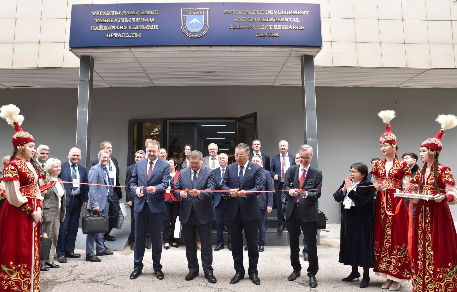
Today, taking into account the main challenges of our time - global and regional changes in the environment, geography and related sciences: meteorology, hydrology, geodesy and cartography, land management, cadastre, GIS technologies, tourism are very important areas of national security and sustainable development of our country. The issues of climate change and adaptation, water and energy security are coming to the fore.
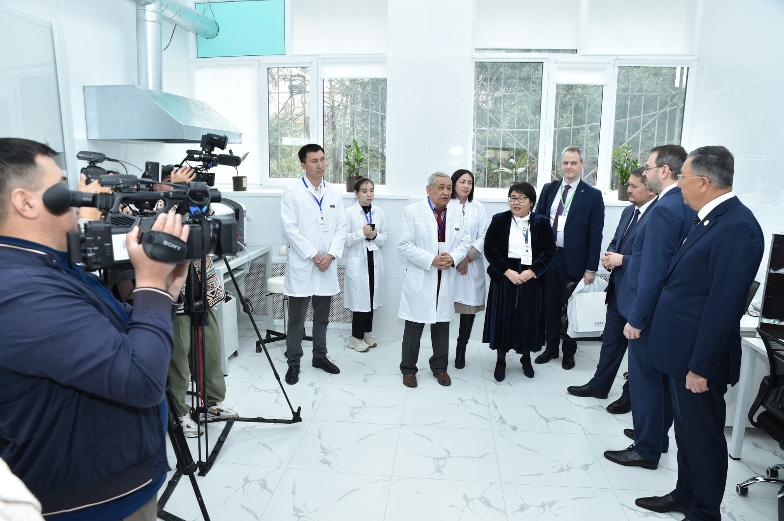
Only geography can help to comprehensively assess the space, territory, resource potential, the possibility of making decisions based on constant monitoring of ongoing processes, identifying the most important trends, which allows us to develop effective mechanisms for adaptation and increasing sustainability.
The purpose of the center is to identify patterns of interaction between nature and society in the context of global environmental change, including the development and implementation of green technologies for the rational use of natural resources for the sustainable development of the regions of Kazakhstan.
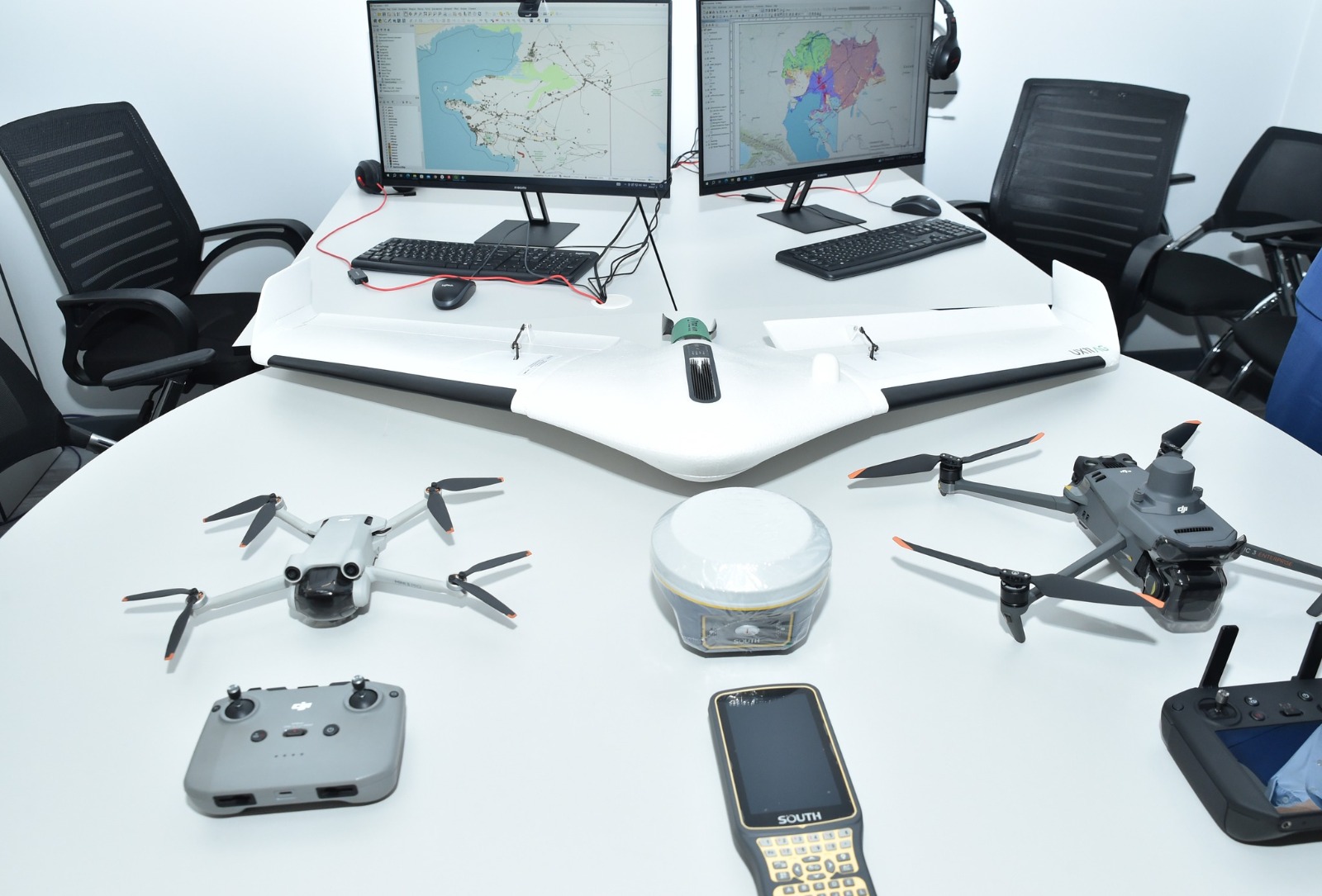
Priority research includes: natural and anthropogenic dynamics of geosystems, soils, topography and landscapes, development of scientific foundations for nature conservation, regional features of sustainable development, geoinformation technologies and mapping.
The tasks of the center:
- development of scientific and methodological foundations for the provision of geographical and environmental education, interdisciplinary connections and improvement of their content, as well as work on the introduction of innovative technologies and the final results of scientific research in the field of education;
- study of natural and anthropogenic changes in the environment and implementation of nature protection measures for sustainable development;
- scientific and methodological support of scientific projects and consulting on the implementation of scientific works;
- creation of a dialogue platform for scientists and specialists in the development of green technologies;
- strengthening cooperation with research and educational institutions and organizations of a geographical and environmental profile;
- solving the problems of regional geoecology and regional geoecological monitoring;
- development of methodology and theory of formation of aquatic land complexes and their ecological status;
- consideration of the problems of remote sensing of the Earth;
- development of systems of methods for ecological and geographical assessment of the region based on a system of geoecological models;
- assessment of threats to biological diversity;
- development of approaches to ecological and geographical assessment of the territory in order to maintain ecological diversity;
- analysis of dynamics and forecasting of landscape-geochemical processes in desert, steppe, forest-steppe regions of Kazakhstan;
- landscape and geographical support of environmental policy in the environmental management of the regions of Kazakhstan;
- analysis of socio-geographical processes and modernization of territorial structures of Kazakhstan in the context of national priorities and global challenges of the XXI century;
- atlas mapping and mathematical modeling of the territorial transformation of nature, economy and population of Kazakhstan.
There are 10 laboratories in the scientific center:
1) Climate and modeling laboratory,
2) Digital cartography and applied geodesy laboratory,
3) Global Sky laboratory,
4) Sustainable tourism laboratory,
5) Modeling the dynamics of the qualitative composition of water resources laboratory,
6) Geoinformation analysis of landscape degradation laboratory,
7) Geodemographic and socio-economic researches laboratory,
8) Environmental safety laboratory,
9) Soil ecology laboratory,
10) Environmental monitoring and sustainable development laboratory.
More information:
https://www.youtube.com/watch?v=_dafGu5Mtgs
https://web.telegram.org/a/#-1001789577427_37039
https://t.me/SayasatNurbek/7912м
https://t.me/SayasatNurbek/7913
https://www.facebook.com/share/eRwSmFPpx8NZL1jX/
https://www.facebook.com/share/v/uQhqqhnSJ6A7KXGo/
https://www.facebook.com/share/v/uQhqqhnSJ6A7KXGo/
https://dknews.kz/ru/dk-life/321661-kaznu-na-peredovoy-nauki-otkryty-10-innovacionnyh
https://dknews.kz/kz/kazak-tilindegi-makalalar/321662-kazuu-ozyk-gylymda-turakty-damu-ushin-10
https://qazaq.asia/newskz/az-y-ozy-ylymda-t-ra-ty-damy-shin-10-innovaciialy-zerthana-ashyldy/
Head of the laboratory: Cherednichenko Vladimir Sergeevich, Doctor of Geographical Sciences, Professor
The purpose of the laboratory is to study the manifestation of regional climate changes in the territory of Kazakhstan.
Climate change is understood as long-term temperature changes and changes in weather conditions. These changes can be natural, caused by changes in the activity of the Sun or large volcanic eruptions and anthropogenic. The study showed the cyclical nature of climate change in 120,000 years and the contribution of anthropogenic influence is 0.17%.
The SMIR 5 model will be used as the main modeling tool, with a basic forecast of RCP 4.5 (if there is sufficient time, the RCP 8.5 scenario will be added), convenient maps with a projection of seasonal changes in temperature and precipitation for the period up to 2050 with a discreteness of 10 years will be presented for colleagues from parallel subjects.
The laboratory was established on the basis of the Department of Meteorology and Hydrology. The department is the largest training base in the Republic for highly qualified meteorologists. The uniqueness of the department is that the department has preserved the fundamental scientific school. The department maintains stable relations with Russian universities such as the Russian State Hydrometeorological University, Moscow State University.
Laboratory scientists are developing new methods for solving such a complex task as modeling climate systems. This problem is currently being solved by numerical analysis of complex systems of equations, such as, for example, Models of the general circulation of the atmosphere and ocean. This approach faces significant difficulties, primarily due to the inability to take into account all the factors at work.
The laboratory scientists intend to develop a fundamentally different approach: forecasting will be based on empirical models obtained from direct analysis of the spatial and temporal dependencies of certain parameters of the climate system.
Solving these tasks will make it possible to predict in advance such extreme events as storms, droughts, heavy precipitation, forest fires, etc., to assess and compare the degree of influence that natural and anthropogenic factors have on global warming.
The results of the work and their novelty. The establishment of the laboratory can contribute to the accelerated development of improved climate forecasts and climate services in Kazakhstan.
Head of the laboratory: Asylbekova Aizhan Asylbekovna, PhD Doctor, Associate Professor, Head of the Department of Cartography and Geoinformatics
The purpose of the laboratory is to realize the accumulated research potential of scientists, teaching staff and students of the Department of Cartography and Geoinformatics to solve the problems of the agricultural, construction, mining sectors of the economy of Kazakhstan.
The laboratory's activities are aimed at solving problems in the following areas:
- Engineering services.
- Participation in research projects, in GF and PCF competitions
- Consulting and educational services.
In the laboratory's activities, the indicators for performing these tasks are:
- The State program of digital development of agriculture E-APK;
- The concept of the development of the geological industry until 2030;
- The State program of housing and communal development "Nurly Zher" for 2020-2025; the State program of infrastructural development of the Republic of Kazakhstan "Nurly Zhol" for 2020-2025.
The financing of the laboratory's activities will be carried out on the basis of:
- applied research and orders from private firms and industry organizations;
- orders within the framework of grant and program-targeted projects;
- contractual work with organizations within the framework of an accredited laboratory.
Estimated sources of income:
- advanced training courses for students and IT specialists;
- applied research within the framework of grant works;
- scientific and applied research within the framework of industry work;
- contractual work within the framework of an accredited laboratory.
Marketing and sales strategy:
- The marketing strategy in the target market involves increasing the volume and types of work provided, opening an accredited laboratory with an increase in demand for scientific and applied research and contractual work. With successful development, it is possible to enter innovative markets.
- The development strategy of the laboratory is determined by monitoring the needs of services among potential and prospective customers, the possibility of a flexible pricing policy.
- The marketing strategy in the service market is primarily aimed at avoiding a negative image of the laboratory. As the services are promoted, marketing research is possible.
- The marketing strategy of pricing involves the provision of applied research and scientific and technical works with a small number of analogues.
- The analysis of the marketing strategy involves updating the services provided, calculating and forecasting risks, focusing on the work in demand at a certain moment.
The development plan and tasks of the laboratory:
- Performing applied works and scientific and applied research for the agro-industrial, construction, oil and gas, mining sectors of the economy;
- Implementation of applied works within the framework of grant and state budget financing;
- Implementation of applied works within the framework of international projects;
- Collection and processing of information for submitting articles to scientific journals.
Laboratory tasks will be performed by laboratory staff, as well as additional personnel involved.
Laboratory equipment
- Workplaces with computers (monoblocks) for staff accommodation;
- copying equipment (MFPs);
- specialized equipment and devices;
- Aircraft (quadrocopter) DJI Mavic 3 Multispectral with DJI D-RTK 2 High Precision GNSS Mobile Station GNSS Radio Receiver;
- GNSS receiver SP85 in full kit (base, rover); GNSS receiver E-Survey E300 IMU Pro with VHF in full kit (base, rover);
- GPR kit MG-250/700MZ, GPR kit Triton-M 25/50/100;
- SOKKIA-530R electronic total station, FOCUS electronic total station, South electronic total station;
- Electronic level SPRINTER 50, 250;
- Traceroute receiver;
- applied GIS programs;
- compact safe for storing portable devices and documents.
Head of the Laboratory: Vitaly G. Salnikov, Doctor of Geographical Sciences, Professor, Department of Meteorology and Hydrology
The Innovative Laboratory of Atmospheric Research was established with the aim of developing and implementing advanced technologies and methods for a deeper understanding of atmospheric processes, forecasting weather and the effects of climate change, as well as creating innovative solutions in the field of sustainability and atmospheric air quality management.
The laboratory's activities focus on several areas that are very important for the country's economy:
1. Research of atmospheric hazards and risks associated with the consequences of global and regional climate changes, such as droughts and jute, thaws and severe frosts, as well as the creation of an early warning system.
2. To study the dynamics of the available potential of alternative energy sources in the context of reducing the carbon footprint to achieve carbon neutrality.
3. Study and testing of new methods of active effects on atmospheric processes.
4. Study of modern problems of atmospheric air pollution in order to create a quality management system.
Competitive advantages of the laboratory:
Technological leadership: The laboratory has access to modern technologies and tools for collecting and analyzing specialized data (for example, a meteorological temperature profiler - a remote sensing instrument that measures radiation in the boundary layer of the atmosphere at altitudes from 0 to 1000 meters), numerical chemical-atmospheric models (WRF-Chem - Weather Research and Forecasting (WRF) model coupled with Chemistry) and others.
Expertise and experience: The laboratory team consists of highly qualified specialists with many years of experience in the field of atmospheric research, which ensures a high level of expertise and research.
Innovative methods and approaches: The laboratory has the potential to develop new methods and approaches to the study of the atmosphere, such as the use of Internet of Things (IoT) technology to collect data on weather and atmospheric parameters; satellite observations and remote sensing; methods of modeling and simulation of atmospheric processes; hybridization of mathematical methods using artificial intelligence and neural networks.
Interdisciplinary approach: The laboratory brings together specialists from various fields of science, such as meteorology, hydrology, geography, geoinformatics, ecology, mathematics, artificial intelligence, Big data, computer modeling and others, which contributes to the comprehensive study of atmospheric processes and their interaction with the environment.
Cooperation and partnership: The Laboratory actively cooperates with scientific research institutes, universities, government organizations and private companies at both national and international levels, which facilitates the exchange of knowledge, experience and resources.
Relevance of the results: The results of the work of the innovative laboratory of atmospheric research can be in demand by a wide range of users, including:
1. Government agencies and services:
- Kazhydromet: to improve weather forecasts, early warning of natural disasters and air quality monitoring.
- Akimats at all levels, as well as ministries and departments responsible for ecology, agriculture, energy, transport and water resources management: to make informed decisions, optimize resource use and reduce risks associated with weather and climate.
- Emergency services: to effectively respond to natural disasters and minimize their consequences.
2. The private sector:
- Subsurface users to reduce the risks of exceeding the limits of atmospheric air pollution and the environment in general.
- Agricultural enterprises: to optimize agricultural production, increase yields and reduce weather-related risks.
- Energy companies: to forecast energy demand, optimize the operation of power plants and develop renewable energy sources.
- Insurance companies: to assess weather and climate-related risks and develop insurance products.
- Transportation companies: to optimize routes, reduce the risks of delays and improve transportation safety.
- Travel companies: to forecast weather conditions and attract tourists.
3. The scientific community:
- Universities and research institutes: to conduct further research in the field of atmospheric sciences, develop new technologies and models.
- International organizations: for climate monitoring, assessment of climate change risks and development of adaptation and mitigation measures.
4. Population: to get information about the weather, air quality and disaster risks.
5. Mass media: to inform the public about the weather, climate and the environment.
Atmospheric research is closely integrated with the Sustainable Development Goals: SDG 2 - Ending hunger, ensuring food security, SDG 3 - Good health and well-being, SDG 4 - Quality education, SDG 7 - Affordable and clean energy, SDG 9 - Industry, innovation and infrastructure, SDG 11 - Sustainable cities and human settlements, SDG 13 - Combating climate change, SDG 15 - Conservation of terrestrial ecosystems, SDG 17 - Partnership for Sustainable Development.
The GlobalSky Laboratory at Al-Farabi Kazakh National University is an important component of academic and scientific activities, contributing to the development of scientific potential, attracting talented specialists and strengthening the university's position as a leader in the field of atmospheric sciences.
Head of the laboratory: Artemyev Alexander Mikhailovich, Candidate of Technical Sciences, Honored Instructor of Tourism of the Republic of Kazakhstan
The Laboratory continues the traditions of the only scientific school of tourism geography in Kazakhstan, created by the founder of the department, Professor S.R. Yerdavletov.
The purpose of the Sustainable Tourism Laboratory is to implement the trend of sustainable development of territories through the synergetic effect of tourism in the context of socio–economic development of the region.
Tasks:
1. Conducting comprehensive studies to assess the current state of the tourism sector, taking into account its impact on the environment, socio-cultural aspects and economic development. Identification of key issues and challenges for sustainable tourism development.
2. Development of innovative methods and tools for assessing the sustainability of tourist destinations. Development of recommendations on the implementation of the principles of sustainable tourism in various fields of tourism activity.
3. Development of training programs and seminars for representatives of the tourism industry, the academic environment and the tourist community. Support and dissemination of knowledge on sustainable tourism through publications, webinars and other educational formats.
4. Preparation and implementation of pilot sustainable tourism projects with an emphasis on environmental and socio-cultural responsibility, as well as support for local communities. Evaluating the effectiveness and replication of successful practices in various geographical contexts.
5. Establishment and development of partnerships with representatives of the tourism business, government agencies, educational and research institutions and public organizations. Active cooperation with international research centers on sustainable tourism.
6. Participation in the development and promotion of standards and certification procedures for sustainable tourism enterprises and projects. Encouraging the implementation and observance of the principles of sustainability by participants in the tourism market.
7. Implementation of a system for monitoring and assessing the sustainability of tourism initiatives. Providing feedback and recommendations for continuous improvement of practices and strategies in the field of sustainable tourism.
Within the framework of the project, comprehensive studies will be carried out to assess the current state of the tourism sector and its impact on the environment, socio-cultural aspects and economic development.
The participation of the Sustainable Tourism Laboratory in the Mega-project is due to the multiplicative effect of tourism activities in the economy, ecology, and social sphere, affecting more than 30 business sectors.
In the economy, it is the creation of new jobs and an attractive investment climate in the service sector.
In the social sphere, it is the preservation of cultural and historical heritage, the revival of national identity, the strengthening of social unity, the demonstration of openness and traditional Kazakh hospitality.
In the field of environmental sustainability – conservation of natural resources, environmental education, education of responsible attitude to the unique nature of Kazakhstan based on the principles of sustainability and patriotism.
In cooperation with partners and other project participants, comprehensive studies will be carried out to assess the current state of the tourism sector and its impact on the environment, socio-cultural aspects and economic development.
Taking into account the identified problems and challenges, an assessment of the total tourism potential, risks and prospects for sustainability will be carried out, scientific recommendations on the implementation of the principles of sustainable tourism in various spheres of tourist activity will be developed.
Economic efficiency is achieved through the introduction of innovative methods and approaches to sustainable tourism, which contribute to increasing the competitiveness of tourism enterprises and attracting investment in the industry. Practical solutions for the formation of a modern “green” infrastructure can support the growth of tourist activity and a corresponding increase in income. At the same time, the implementation of sustainable tourism projects supported by the laboratory can contribute to stimulating the local economy through the development of small and medium-sized businesses, creating new jobs and increasing the volume of consumption of goods and services.
Environmental efficiency is due to the expansion of the possibility of preserving natural resources through the development of methods for the sustainable use of natural resources aimed at minimizing the negative impact of tourism on ecosystems. The laboratory's projects in the field of environmental education and enlightenment will contribute to the formation of an ecological culture among tourists, which is important for the preservation of the natural environment. The introduction of innovative practices and technologies can help reduce the carbon footprint of tourism by reducing greenhouse gas emissions and maintaining climate sustainability.
Social effectiveness is manifested in the support of local communities. Sustainable tourism projects will promote the involvement of the local population in tourism activities and contribute to the preservation of cultural heritage. Educational and cultural programs aimed at developing the knowledge and skills of local residents have a positive impact on the quality of life. At the same time, the development of sustainable tourism contributes to the creation of new jobs, which is important for reducing unemployment and improving the well-being of the population.
As a practical tool and as a result of research, databases will be compiled and assessment maps created, calculations of tourist and recreational load will be performed, the route tourist network will be adapted, calculation methods improved, training programs for business representatives and local communities, including guides, educational events organized, monitoring programs worked out.
The results of the work will be used by authorized bodies for planning and management, tourist enterprises and organizations – to ensure the sustainability of the development of project territories in the process of doing business, protected areas – to assess the recreational load on tourist routes and ecological trails, educational institutions – in the training and retraining of personnel, scientific organizations – to form the scientific basis for sustainable development of the regional tourism, local communities – for the organization of tourist services and the development of infrastructure in the field of tourism and hospitality. The social effect is also important – fostering respect for natural and cultural-historical sites, patriotism, demonstration of openness and hospitality, formation of an attractive tourist image of the region.
At this stage, in the first six months, a methodological research base has been prepared, a situational analysis on the ground has been performed, key indicators for assessing the sustainability of tourism development have been identified, author's models of regional tourism development in the West Kazakhstan region have been developed and an appropriate author's certificate has been obtained, an article has been prepared in a rating journal included in the Scopus database, preparations for field research are underway.
The main task of assessing the socio-economic development of the West Kazakhstan region in the context of sustainable development is solved on the basis of the GSTC-D criteria developed by the Global Council for Sustainable Tourism in order to ensure a common understanding of tourism sustainability. The criteria are grouped into four main themes: sustainable management; socio-economic impacts; cultural impacts; environmental impacts and applicable to the entire tourism sector.
All global criteria for sustainable tourism are attached directly related to the UNDP Sustainable Development Goals (SDGs) and are used:
- as a basis for sustainability certification;
- as basic guidelines for tourist destinations that want to become more sustainable;
- to help consumers identify successful sustainable tourist destinations;
- as a guide for the media to recognize destinations as sustainable and inform the public about it;
- in order to assist in the implementation of certification programs and other programs at the level of destinations in ensuring that their standards comply with generally accepted basic indicators;
- when developing government and non-government programs, as well as private sector programs, as a starting point for developing requirements for the development of sustainable tourism;
- as basic guidelines for educational institutions and organizations for professional training in the field of tourism and hospitality;
- to demonstrate leadership that inspires others to take action.
Although these criteria relate mainly to the place and not to the authority, many of them can be initiated and applied through the destination Management Organization (DMO), responsible for a coordinated approach to the development of sustainable tourism within the territory, as well as individual tourism enterprises, other facilities and forms of economic activity and entrepreneurship.
It should be noted that the criteria indicate what should be done, not how to do it or whether the goal has been achieved. This role is fulfilled through performance indicators, relevant training materials and access to implementation tools, which are an integral complement to the global criteria for sustainable development, which, in fact, is one of the main objectives of the project.
Head of the Laboratory: Lyudmila Mikhailovna Pavlichenko – Doctor of Geographical Sciences, Professor of the Department of Recreational Geography and Tourism, Faculty of Geography and Environmental Management
The purpose of the laboratory is to model the dynamics of the qualitative composition of water resources, which includes several aspects:
1. Investigation of water quality parameters: The laboratory analyzes and evaluates various water quality parameters, such as pollution levels, the content of various chemicals, etc.
2. Assessment of the impact of anthropogenic factors: The laboratory examines the impact of anthropogenic activities on water quality, such as discharges of treated wastewater from industrial enterprises and utilities, drainage of irrigation waters of agricultural massifs and animal stall facilities, etc.
3. Modeling the dynamics of changes in water quality: Using mathematical models of dilution of wastewater discharges or discharge of contaminated groundwater, the laboratory creates models that allow predicting changes in water quality along a river stream.
4. Identification of natural and anthropogenic processes that form the actual measured concentrations and composition of water quality indicators, with the construction of a map of the territorial dynamics of the intensity of the identified processes based on the use of multidimensional statistical models.
5. Development of measures to improve water quality: Based on the results of field research, surface and groundwater quality monitoring data and modeling, the laboratory offers recommendations and strategies for possible improvement of water quality and pollution prevention.
The purpose of the laboratory is to assess and predict the dynamics of the qualitative composition of groundwater and surface waters based on the use of multidimensional statistical and analytical mathematical models.
The results of the models provide the development of water quality management methods aimed at improving the environmental sustainability of aquatic ecosystems and ensuring the safety of water resources.
Laboratory tasks:
1. Preparation of initial data on the qualitative composition of water resources (pollution parameters, pollution sources, data on the current state of water bodies);
2. Analysis of the chemical composition of water resources at the research site;
3. Performing multispectral surveys of surface water resources and creating an orthophotoplane;
4. Determination of complex indicators of water quality and analysis of possible sources of pollution and the nature of interaction with groundwater;
5. Construction of maps of the territorial dynamics of the intensity of the processes of formation of surface water quality identified by mathematical methods.
When performing research in the laboratory, the following equipment is used: a portable laboratory for water quality analysis; laying-laboratory "VHF-2" for field chemical control; an aircraft (DJI Mavic 3 Multispectral quadcopter), etc. In addition, the laboratory is currently transferring a multidimensional statistical software package to a new modern level - a complete model of component analysis with the construction of the type of main components, the objective interpretation of which provides the identification of natural and anthropogenic factors of changes in the quality of water resources and the territorial distribution of the intensity of their impact.
The laboratory analyzes the composition of water resources for the presence of various pollutants and determines their level, which makes it possible to assess the degree of environmental impact and take measures to reduce the negative impact on ecosystems.
The use of the analysis results makes it possible to take measures to protect public health and prevent the spread of infections through water.
Laboratory data will allow government agencies and local executive bodies to make informed decisions related to the use of water resources, and will help determine the need to introduce additional measures for the purification and protection of water resources.
The laboratory can contribute to the achievement of SDG 6 through the development and application of innovative methods and models to improve water quality control and management, which in turn can contribute to the conservation and restoration of water ecosystems.
The development of an innovative software package that implements a complete model of component (factor) analysis allows us to judge specific natural and anthropogenic processes and the intensity of their manifestation in the formation of water quality, unlike all advertised statistical complexes, where the model of factor (component) analysis is limited to determining only eigenvalues and eigenvectors that do not take into account the distribution of the values of the initial parameters by observation points. The use of such limited models in cognitive modeling can lead to errors in the development of management decisions.
Head of the laboratory: Tokbergenova Aigul Abdugapparovna, Candidate of Geographical Sciences, Associate Professor. Head of the Department of Geography, Land Management and Cadastre
The main task of the laboratory is to monitor, evaluate and predict the processes of landscape degradation and develop scientifically sound recommendations for preventing degradation processes using geoinformation technologies (GIS) and remote sensing.
The laboratory conducts research on the restoration of degraded landscapes and land management using remote sensing data. The laboratory's work is aimed at the implementation of Goals 13 and 15 of the UN SDGs.
The uniqueness of the laboratory lies in the use of remote sensing data to monitor and predict the processes of landscape degradation, as well as in the compilation of models for short- and long-term forecasting of the degree of risk of desertification and the resilience of landscapes to anthropogenic impact in the context of climate change. Researchers have the opportunity to work internationally with international partners such as the Institute of Water Resources, Environment and Health of the United Nations University (Canada), the International Rice Research Institute (Philippines) and Michigan State University (USA).
The main areas of work are Monitoring, assessment and analysis of risks, cartographic modeling and forecasting of processes of degradation of landscapes and land resources. Development of scientifically based recommendations and requirements to prevent further degradation and restoration of damaged landscapes, as well as the introduction of innovative methods of rational land use.
Research results: assessment and application maps of the development of desertification processes have been developed; using long-term remote sensing data, a model for predicting the degree of desertification risk in the southern region of the republic has been developed; recommendations on the secondary use of collector waters for irrigation of arable land have been developed; recommendations on improving methods of phytomelioration-fixing sands of degraded pastures with woody, shrubby and herbaceous vegetation (based on new genotypes of drought-resistant plants). Currently, the research group is working on compiling a model for the effective use of agricultural landscapes against the background of global climate change and a decrease in water resources of transboundary rivers using remote sensing data to increase yields and rational use of agricultural land
We work together and provide the results to the Committee on Land Management of the Ministry of Agriculture of the Republic of Kazakhstan (KUZR of the Ministry of Agriculture), the Department of Land Cadastre, the Department of Agrochemical, Soil Surveys and Complex Survey Work of the NAO "State Corporation "Government for Citizens" and local executive bodies (MIO).
Head of the laboratory: Gulnara Nurmukhamedovna Nyusupova, Doctor of Geographical Sciences, Professor
The laboratory is based on the basis of the only demographic school in the republic, which explores such aspects as the relationship of demographic processes with social and economic factors.
The purpose of the laboratory: To conduct comprehensive research in the field of geodemography, social and economic geography, includes the study of demographic processes and trends, analysis of socio-economic phenomena and their spatial differentiation, as well as assessment of the impact of these factors on the sustainable development of regions and society.
To achieve these goals, the laboratory is equipped with modern computer and office equipment, ArcGIS Pro software, GPSMAP 67 GPS navigator, DJI Air 3 Fly More Combo (RC 2) quadcopter, Canon EOS R6 Mark II RF 24-105 F4-7.1 IS STM system camera and other peripherals and network equipment totaling 20.8 million tenge.
Within the framework of geodemographic and socio-economic research, in recent years, the scientists of our laboratory have implemented several research projects. An electronic atlas of socio-demographic processes of the Republic of Kazakhstan has been compiled, based on the methodology of a comprehensive spatial assessment of the quality of life of the population of Kazakhstan, the geographic information portal AIS KZHN of the regions of the Republic of Kazakhstan was created for the first time on the GIS platform. The author's methodology for calculating the integral KZHN index based on selected 31 key indicators for demographic, social, economic and natural-ecological blocks has been developed. A GIS functionality has been developed, where vector cartographic data of the Republic of Kazakhstan is loaded using an open source cartographic server – Mapserver, which serve as the basis for thematic and integral maps of KZHN indicators. According to the results, articles were published in the highly rated journals Scopus, Web of Science, textbooks, monographs and author's certificates were obtained. Also, at the moment, within the framework of SDG 11 “Sustainable cities and human settlements”, our laboratory is working on a comprehensive assessment of the sustainable development of large cities of the Republic of Kazakhstan.
The research group, within the framework of the mega-project, plans to conduct a sociological survey of the population in the West Kazakhstan region along with the analysis of official statistical data to identify the level of quality of life of the population. The labor market and labor resources will be studied, migration movements of the population will be monitored, demographic forecasts and models of socio-economic development will be developed based on the geospatial data obtained. The research results will be published in peer-reviewed scientific journals and monographs.
The research and scientific results of the laboratory are used in the development of State programs and social projects aimed at improving the quality of life of the population, which in turn will have a positive impact on the socio-economic development of the republic. Spatial Databases and their analytics developed by the laboratory can be used for planning and forecasting sustainable development of human capital, attracting internal and external investments, reflecting the potential development opportunities of the regions of the republic.
Head of the laboratory: Askarova Maulken Akishevna, Doctor of Geographical Sciences, Professor of the Department of Geography, Land Management and Cadastre
Objective: to develop scientific and applied aspects of environmental safety management based on a comprehensive study of the ecological state of natural and economic systems in Kazakhstan in the context of sustainable development.
Tasks:
1. To develop the concept of environmental safety management of natural and economic systems of the Republic of Kazakhstan.
2. To conduct research on the identification and identification of existing environmental challenges and threats in Kazakhstan as an information basis for ensuring environmental safety.
3. To develop a classification of all types of challenges and threats of a natural and anthropogenic nature in the Republic of Kazakhstan.
4. To investigate and assess the levels of environmental safety in the natural and economic systems of the Republic of Kazakhstan.
5. To develop a scientifically based comprehensive system of measures to manage the environmental safety of natural and economic systems of Kazakhstan.
The results of the study:
According to the objectives, the concept of environmental safety has been developed, which consists of 2 blocks: a database and information and an action block. The first block provides for the collection of information and databases, the research area and characteristics of the characteristics of their natural environment, the identification and identification of environmental challenges and threats, followed by their systematization. Regarding global threats, we will study the impact of climate change in the regional aspect on environmental security, among the regional threats are the ecological state of the transboundary Zhaiyk River and its tributaries, and the biodiversity of the region. Hydrocarbon production sites and atmospheric pollution will be investigated as local threats.
The first block also includes a component-by-component assessment, that is, by components of the natural environment: by atmospheric environment, this is air pollution, hydrosphere environment - this is pollution of rivers and reservoirs and lithospheric environment, which represents the degradation and desertification of land resources and soils of the West Kazakhstan region. We will also be able to study the impact of pollution on the health of the local population and make a map of the environmental risk to the health of the population of the studied region, based on an assessment of environmental safety levels. Then a general integrated assessment of environmental safety levels will be given separately for four regions, and for the entire West Kazakhstan region.
To calculate the component-by-component and integral assessment of environmental safety, author's methods and special calculation formulas will be proposed. The necessary data for calculating the environmental safety assessment will be kindly provided to us by our colleagues in the Megagrant as a result of field and experimental work by their laboratories in relation to the West Kazakhstan region. Since we have a modular principle of research work, each laboratory should rely on the data of its colleagues in the consortium conducted and received today in the study of a particular problem.
The second block has an applied aspect, i.e., according to the algorithm of the conceptual scheme developed by us, it includes actions in different environmental situations of changing the natural environment in conditions of natural or man-made disasters. This is the analysis of alternatives and the choice of management decisions, then the implementation of management decisions and controlling. The management measures we offer can be used in the following 4 environmental situations:
- in a natural background environmental situation
- in a background hazardous environmental situation
- in an extreme environmental situation
- in a post-extreme environmental situation
The next stage is controlling, it is a comprehensive event management support system aimed at coordinating the interaction of management systems and monitoring their effectiveness. That is, it includes both monitoring of planning, organization and action and monitoring of their implementation.
The work has an important economic, ecological and social effect, since sustainable development is their harmonious combination.
The economic effect is achieved through the most efficient and rational use of available resources to ensure stable economic activity and eliminate or minimize possible external and internal challenges and threats to their degradation.
The ecological effect consists in the identification, systematization and assessment of environmental challenges and threats of a natural and man-made nature. Recommendation of measures for environmental safety management in various environmental situations.
The social effect is determined by recommendations on environmental safety management under extreme environmental conditions (emergencies), ensuring the safety of life and preventing human casualties, material damage, and environmental degradation.
Thus, achieving sustainable development by creating a favorable and clean environment for living and living, ensuring the protection of natural resources and biodiversity, avoiding man-made accidents and catastrophes is sustainable development.
Head of the laboratory: Mukanova Gulzhanat Amangeldikyzy, PhD, Associate Professor, Acting Professor of the UNESCO Department of Sustainable Development
The Laboratory of Soil Ecology of the Faculty of Geography and Environmental Management of Al-Farabi Kazakh National University was established with the financial support of the KN of the Ministry of Foreign Affairs of the Republic of Kazakhstan.
The purpose of the laboratory is to carry out fundamental and applied scientific research, taking into account the directions of development of science, education and their implementation in the educational process.
The main task of the laboratory is to solve fundamental problems of soil science, ecology and environmental management related to the formation, functioning, conservation and reproduction of soils of the Republic of Kazakhstan.
Functions - Research of natural and anthropogenic environmental factors, monitoring, creation of GIS of research objects, creation of a spatial and temporal database and mapping of work results for the purpose of sustainable and stable development of agricultural, industrial and other sectors of the regions of the Republic of Kazakhstan.
His research interests include: soil science genesis, morphology, geography and cartography of soils, their classification, evolution, ecological functions, general problems of the theory and history of soil science; monitoring of soil chemical composition in order to assess their ecological condition; soil zoology, as well as soil biodiagnostics.
The integration of these knowledge blocks will make it possible to qualitatively assess the ecosystem functions of soils as the basis of the biological diversity of terrestrial ecosystems.
The laboratory is equipped with the latest equipment - 99-0578-00 GBC SavantAA Atomic absorption spectrometer; Biological microscope; Desktop soil laboratory NPL-2; Satchel soil laboratory RPL-3; pH meter/ionomer ITAN; Analytical scales VL-124V; Laboratory scales VLTE-510C; etc., which allows you to solve the following tasks:
- to evaluate the main chemical, morphological and physical indicators of the state of soils and soils;
- determine the components in the soil ammonium nitrogen, cation exchange capacity, calcium and magnesium in total, carbonate and bicarbonate ions, etc;
- analysis of solid and liquid samples for the content of various metals in them (most of the periodic table), as well as for quality control of finished products.
- study of low-contrast tissue cell cultures, liquid precipitation, etc.
The main areas of research:
- assessment of the current ecological state of soils and monitoring of their transformations under conditions of anthropogenic impact;
- study of the physico-chemical and biological properties of soils of technogenically disturbed soils and the establishment of their reclamation potential;
- study of meso- and microfauna of soils as bioindicators of ecological status.
The objects of the study are soils from different regions of the Republic of Kazakhstan.
The laboratory staff carries out research work throughout the republic.
An electronic database of physico-chemical and geochemical information is being created as the basis for complex monitoring observations and forecasting the development of environmentally hazardous processes. The modern park of devices in the laboratory meets all requirements, all means of equipment are included in the state register of the Republic of Kazakhstan.
The results obtained:
- Cartographic material is presented on the geosystems of the river basins of the southeastern part of the Balkhash region, for use by local authorities and other interested persons.
- Environmental protection measures have been developed for the rational use of natural resources aimed at improving the processes of development of water, land and biotic resources of the Karatal-Lepsinsky interfluve.
- on the map of anthropogenic modification of the Karatal-Lepsinsky Interfluve, 5 types of anthropogenic modifications inherent in this territory are identified. A strong degree of degradation of pastures is observed in the Srednekaratalskaya, Sredneaksa geosystems, a high degree of degradation is observed everywhere in sandy massifs.
- to solve the local problems of the studied region, it is recommended to use a geosystem-basin approach;
- A component analysis of the landscapes of the Karatal, Aksu and Lepsin macrogeosystems identified the genetic components of the bioproductivity dispersion, giving a predominant role to groundwater (58.49%), highlighting a significant role (33.11%) to the factor of variability of geomorphological conditions (the factor of geographical runoff) and a small (8.41%) role of surface waters.
- The dynamics of soil processes in the Akdalinsky irrigation massif has been studied and methods for improving rice crops have been proposed;
- An ecological and geochemical assessment of heavy metal pollution in the territory of the Donskoy GOK in Khromtau was carried out.
- The ability of oil-contaminated soils to withstand anthropogenic stress has been studied.
Head of the laboratory: Bazarbayeva Tursynkul Amankeldievna, PhD, Associate Professor, Head of the UNESCO Department of Sustainable Development
Laboratory of Environmental Monitoring and Sustainable Development of the Faculty of Geography and Environmental Management of Al-Farabi Kazakh National University
The purpose of the laboratory is to conduct comprehensive research on indicators of sustainable development goals, monitoring the environment and natural resources.
The uniqueness of the laboratory lies in the determination of basic indicators of the state of the environment, such as air quality, water, soil, pollution levels, etc.; development of methods for collecting data and monitoring changes based on geodetic measurements, photogrammetry, data from UAVs (unmanned aerial vehicle) and remote sensing; analysis of remote sensing data and images obtained from unmanned aerial vehicles, to identify changes in the physical, geographical and landscape cover; creation of digital maps and models of ecosystems using GIS to visualize and analyze the state of ecosystems.
Practical significance - the research results serve as an important material in the application of optimal methods and methods of irrigation of agricultural fields in arid regions, optimal management of water resources and their adaptation to climate change.
The main task of the laboratory is to study the impact of anthropogenic factors on the geoecosystems of the republic, using GIS technologies,
- development of recommendations for improving the condition of environmental components.
- creation of innovative solutions in the field of sustainable development of the regions of the Republic of Kazakhstan,
- mprovement of environmental monitoring methods.
Functions - Research of natural and anthropogenic environmental factors, monitoring, creation of GIS of research objects, creation of a spatial and temporal database and mapping of work results for the purpose of sustainable and stable development of agricultural, industrial and other sectors of the regions of the Republic of Kazakhstan.
His research interests include: environmental studies using geographic information systems (GIS) and their application in environmental monitoring. The use of geodetic measurements, photogrammetry, data processing from unmanned aerial vehicles (UAVs) and remote sensing to analyze environmental changes is a powerful tool for ecosystem assessment and monitoring.
The integration of these various methods and technologies allows the creation of detailed maps and models of the environment that can be used to assess the state of ecosystems, identify changes in agricultural fields, forests, urban infrastructure and other natural environments. It also allows you to track the dynamics of changes and their impact on the environment.
The modern park of devices in the laboratory meets all requirements, all means of equipment are included in the state register of the Republic of Kazakhstan. Technical equipment consists of basic and portable measuring instruments: Mavic 3 multispectral quadcopter with DRTK station base; Spectra Precision 85 geodetic GNSS receiver; Agisoft, ArcGIS, QGIS, ENVI software for monitoring and processing remote sensing and UAV data. These devices allow you to solve the following tasks:
- determination of basic indicators of the state of the environment, such as air quality, water, soil, pollution levels, etc.;
- development of methods for collecting data and monitoring changes based on geodetic measurements, photogrammetry, data from UAVs and remote sensing;
- analysis of remote sensing data and images obtained from unmanned aerial vehicles to identify changes in the physical, geographical and landscape cover;
- creation of digital maps and models of ecosystems using GIS to visualize and analyze the state of ecosystems;
The main areas of research:
- analysis of the dynamics of changes in the environment under the influence of human activity and natural processes;
- identification and classification of landscape elements and their changes under the influence of anthropogenic and natural processes;
- Using spatial data analysis to identify trends and patterns of change in different regions;
- the use of GIS for the integration and analysis of data on biological diversity, species composition and zoning of ecosystems;
- development of methods for assessing the resilience of ecosystems to anthropogenic and natural changes and their potential consequences.
The objects of the study are various regions of the Republic of Kazakhstan, where the analysis and monitoring of the state of the environment are carried out in order to develop and implement effective strategies for managing natural resources and environmental protection.
1. Research results: thematic maps of a large scale of 1:200,000 in the Almaty region have been developed; (soil-geomorphological, landscape, physico-geographical, geomorphological, hydrological, climatic).
2. The agro-landscape map of the Almaty region with a scale of 1:25,000 is classified at the level of tract, sub-tract and facies, and the options for using GIS technology for each level are determined;
3. The purpose of using GIS technology algorithms in mapping slope steepness and exposure of landscape units classified at the facies level on a scale of 1:25,000 is determined;
4. The risks of water erosion in agricultural landscapes at the level of facies with light chestnut and dark chestnut soils have been determined.
The laboratory staff carries out research work throughout the republic. An electronic database of physico-chemical and geochemical information is also being created as the basis for complex monitoring observations and forecasting the development of environmentally hazardous processes.
Kazakh-Chinese joint laboratory "Remote Sensing Technology and Applications"
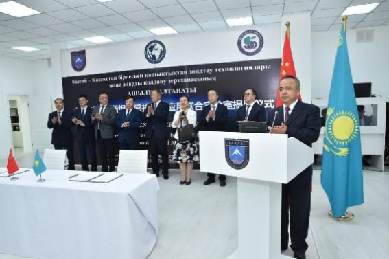
Opening date: March 27, 2024
Novelty: Using space and ground-based observation data to detect changes in environmental processes in real time for subsequent modelling and assessment, identifying key drivers and determining their relationships using modern satellite remote sensing technology and UAVs, as well as GIS image processing software products.
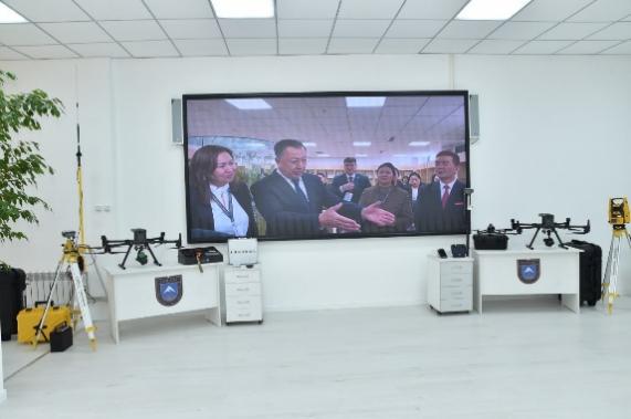

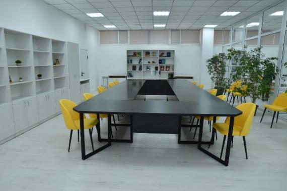
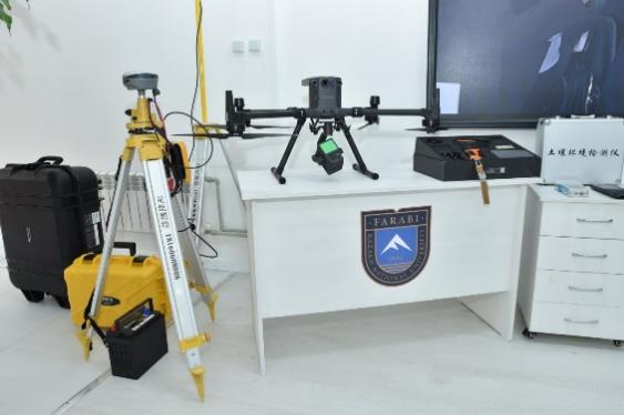
Target: Using satellite remote sensing technologies for Earth monitoring, environmental monitoring and Beidou navigation satellite system for monitoring, early warning and environmental assessment in Central and West Asia.
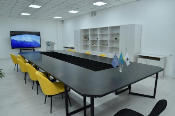
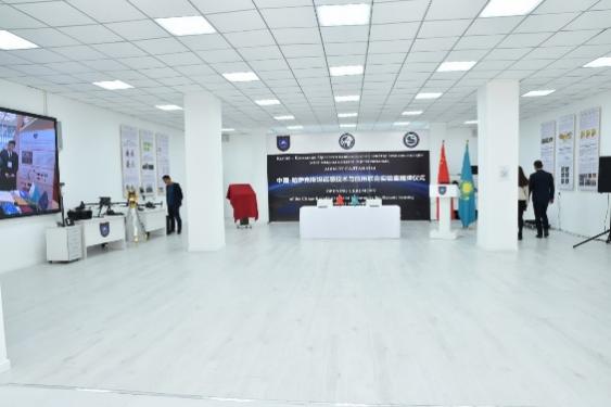
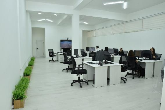
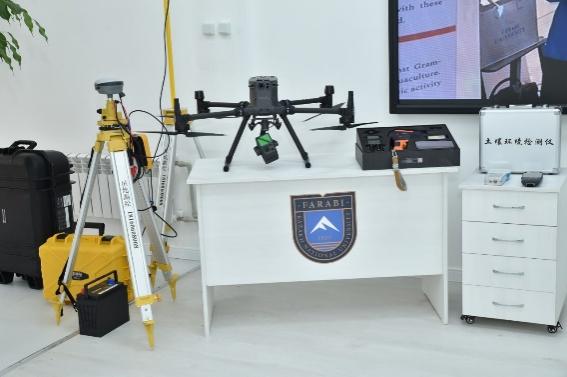
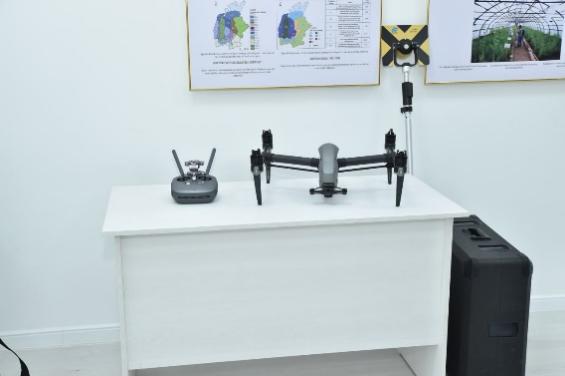
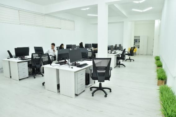
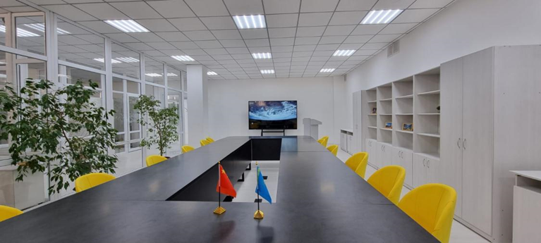
Practical purpose: aims to promote resource sharing and complementary advantages between the two sides and strengthen scientific and technological cooperation as well as personnel exchanges in resource and ecological environment research.
Contacts: dana.shokparova@kaznu.kz; +7(705)114-02-66
International cooperation at the faculty is aimed at:
● stimulation of mutually beneficial cooperation;
● exchange, as well as employees, but also undergraduate, graduate, doctoral students;
● organization of refresher courses;
● development and implementation of joint educational programs, including those providing for the issuance of double diplomas, as well as curricula;
● organizing academic meetings and symposia;
● joint research activities.
● publication of scientific papers in periodicals of the partner university;
● exchange of scientific information;
● attraction of leading scientists for the scientific leadership of PhD doctoral students at the partner university.
Joint publications of professor staff of the Faculty of Geography and Environmental Sciences with foreign scientists
International cooperation at the faculty is reflected in joint types of research activities and publication of scientific works in periodicals.
|
№ |
Authors. Full bibliographic description |
Link |
|
1 |
Aktymbayeva, A., Nuruly, Y., Bazarbekova, M., Kulakhmetova, G., Zhakupova, A., El Archi, Y., Benbba, B., Issakov, Y., & Dávid, L. D. (2023). Advancing Tourism Destination Amidst COVID-19 In Kazakhstan: A Focus on Social Tourism Initiatives. GeoJournal of Tourism and Geosites, 50(4), 1563–1572. |
|
|
2 |
Issakov, Y., Aktymbayeva, А., Assipova, Z., Nuruly, Y., Sapiyeva, A., Shaken, А., Pavlichenko, L., Kaliyeva, А., Plokhikh, R., & Dávid, L. D. (2023). Study of the Impact of UNESCO Heritage Sites on Sustainable Tourism Development: A Case Study of the Mausoleum of Khoja Ahmed Yasawi, Turkestan. GeoJournal of Tourism and Geosites, 51(4spl), 1717–1727. |
|
|
3 |
Volkova, O. A., Spankulova, L. S., & Nuruly, Y. (2023). The Pharmaceutical Insurance as a Mean to Overcome Inequality in Access to Health Care of Population in Kazakhstan. Problemy sotsial'noi gigieny i istoriia meditsiny / NII sotsial'noi gigieny, ekonomiki i upravleniia zdravookhraneniem im. N.A. Semashko RAMN, AO 'Assotsiatsiia 'Meditsinskaia literatura', 31(6), 1427–1432. |
|
|
4 |
Moldagaliyeva, А., Aktymbayeva, А., Issakov, Y., Assylbekova, A., Kenzhalin, К., Beisembinova, A., Begimova, G., & Dávid, L.D. (2024).Socio-Economic Significance of Tourism Development on The Great Silk Road (Kazakhstan Section). GeoJournal of Tourism and Geosites, 52(1), 116–124. |
|
|
5 |
Plokhikh, R., Fodor, G., Shaken, A., Berghauer, S., Aktymbayeva, A., Tóth, A., Mika, M., & Dávid, L.D. (2022). Investigation of Environmental Determinants for Agritourism Development in Almaty Region of Kazakhstan. GeoJournal of Tourism and Geosites, 41(2), 354–361. |
|
|
6 |
Aktymbayeva, A., Orazgaliyeva, A., Omarova, A., Tulaganov, A., Akhmetova, A., Tyurina, Y., & Troyanskaya, M. (2020). The Central Asian Economies of Water-Energy Security: The Future Role of Hydro and Fuel-based Systems. International Journal of Energy Economics and Policy, 11(1), 417–425. |
|
|
7 |
Movkebayeva, G., Aktymbayeva, A., Tyurina, Y., Baikadamov, N., Beketova, K., Troyanskaya, M., Smagulova, S., & Imangaliyeva, A. (2020). Energy Security and Sustainability in Eurasian Economic Union in the Terms of Economic Growth: The Case of Kazakhstan’s Energy Sector up to 2040 Perspectives. International Journal of Energy Economics and Policy, 10(2), 497–503. |
|
|
8 |
Pavlichenko, L. M., Yespolayeva, А. R., Aktymbayeva, А. S., Jones, H., & Yesimsiitova, Z. B. (2019). Summarized Assessment of the Role Oil and Gas Complex Mangystau Region in Pollution Ground Water. WSEAS Transactions on Environment and Development, 15, 438–446. |
https://www.wseas.org/multimedia/journals/environment/2019/a925115-436.pdf |
|
9 |
Kuldeyev E., Seitzhanova M., Tanirbergenova S., Tazhu K., Doszhanov E., Mansurov Z., Azat S., Nurlybaev R., Berndtsson R.(2023) Modifying Natural Zeolites to Improve Heavy Metal Adsorption/ Water (Switzerland), №15. |
https://www.scopus.com/record/display.uri?eid=2-s2.0-85163846422&origin=resultslist |
|
10 |
Farina A., Mullet T.C., Bazarbayeva T.A., Tazhibayeva T., Polyakova, S., Li P. (2023) Sonotopes reveal dynamic spatio-temporal patterns in a rural landscape of Northern Italy, Frontiers in Ecology and Evolution, T.11 |
https://www.scopus.com/record/display.uri?eid=2-s2.0-85170228795&origin=resultslist |
|
11 |
Mkilima T.; Meiramkulova K.; Kydyrbekova A.; Bazarbayeva T.; Daldabayeva G., Zholdasbek A., Shegenbayev A.; Dzhexenbayevv N., Oshanova G.; G. Kaisagaliyeva (2023) Biofilm-Enhanced Natural Zeolite Material in Purification Performance for Slaughterhouse Wastewater, Water (Switzerland), №15
|
https://www.scopus.com/record/display.uri?eid=2-s2.0-85174014013&origin=resultslist |
|
12 |
Умбетбеков А.Т., Абдибаттаева М.М., Su Xintai, Алматова Б.3, Сатарбаева А.С. Soil degradation due to pollution by oil and oil products and the development of a way to prevent them//Вестник КазНУ. Серия экологическая, №2(59) 2019. – Алматы: «Қазақ университеті», 2019. – С. – Алматы: «Қазақ университеті», 2019. – С. 25-37
|
|
|
13 |
Pavlichenko L.M., Rysmagambetova A.A., Rodrigo Ilarri J.The applicability assessment of technical solutions for a feasibility study on the purification of groundwater in the Ilek river valley from boron for the modern hydro geochemical situation// Eurasian Journal of Ecology (2018), Vol 54, N 1, p.35-48. |
https://riunet.upv.es/bitstream/handle/10251/165488/Pavlchenko?sequence=1 |
|
14 |
Kosherbay K., Mussagaliyeva A., Nyussupova G., Strobl J. ANALYSIS OF THE STATE OF PUBLIC TRANSPORT IN ALMATY (2022) Geojournal of Tourism and Geosites , 45 (4), pp. 1534 - 1542 |
https://doi.org/10.30892/gtg.454spl01-972
|
|
15 |
Stepanov A., Burnasov A., Ilyushkina M., Kovalev Y., Nyussupova G. Sustainable development, climate policy and environmental transformation of the Baltic region economies: A comparative analysis (2020) E3S Web of Conferences, 208, art. no. 03055 |
|
|
16 |
Nyussupova G., Rodionova I. Demographic situation and the level of human development of the Republic of Kazakhstan: Regional aspects (2011), 16, pp. 75 - 87 |
|
|
17 |
Zhang B., Nadyrov S., Sorokina N., Chaynikova L. ROLE OF THE SILK ROAD ECONOMIC BELT IN ACHIEVING SUSTAINABLE ECONOMIC GROWTH IN CENTRAL ASIA (2023) Journal of Law and Sustainable Development, 11 (2) |
https://doi.org/10.55908/sdgs.v11i2.385
|
|
18 |
Zhang B., Nadyrov S., Sorokina N., Chaynikova L. ROLE OF THE SILK ROAD ECONOMIC BELT IN ACHIEVING SUSTAINABLE ECONOMIC GROWTH IN CENTRAL ASIA (2023) Journal of Law and Sustainable Development, 11 (2) |
|
|
19 |
Gagarina G.Y., Sorokina N.Y., Chainikova L.N., Sizova D.A., Nadyrov S.M. Tools to ensure the economic security of the old industrial regions (2019) Entrepreneurship and Sustainability Issues, 7 (1), pp. 747 - 762 |
|
|
20 |
Gabdrakhmanova R.G., Khuziakhmetov A.N., Yesnazarova U.A. Pedagogical conditions of socialization of senior pupils in school labor unions (2016) Mathematics Education, 11 (1), pp. 113 - 121 |
|
|
21 |
Khuziakhmetov A.N., Aminov T.M., Yesnazarova U.A. Madrasahs as vocational educational institutions in the regions of pre-revolutionary Russia (2016) International Journal of Environmental and Science Education, 11 (3), pp. 195 - 205 |
|
|
22 |
Gabdrakhmanova R.G., Khuziakhmetov A.N., Yesnazarova U.A. The formation of values of education in the mathematics teachers of the future in the process of adaptation into university study (2015) International Electronic Journal of Mathematics Education, 10 (3), pp. 147 - 155 |
|
|
23 |
Baltiyeva A.A., Raskaliyev A.S., Shamganova L.S., Fan H., Abdykarimova G.B. Acceptance tests of the software and technical complex of the high-precision satellite positioning system in the Kacharsky mine (2020) News of the National Academy of Sciences of the Republic of Kazakhstan, Series of Geology and Technical Sciences, 6 (444), pp. 33 - 40 |
|
|
24 |
Medeu A.R., Popov N.V., Blagovechshenskiy V.P., Askarova M.A., Medeu A.A., Ranova S.U., Kamalbekova A., Bolch T. Moraine-dammed glacial lakes and threat of glacial debris flows in South-East Kazakhstan (2022) Earth-Science Reviews, 229 |
|
|
25 |
Amirgaliev N.A., Askarova M., Opp C., Medeu A., Kulbekova R., Medeu A.R. Water Quality Problems Analysis and Assessment of the Ecological Security Level of the Transboundary Ural-Caspian Basin of the Republic of Kazakhstan (2022), 12 |
|
|
26 |
Amirgaliev N.A., Opp C., Askarova M., Kulbekova R.A., Ismukhanova L.T. About ratio and values of the empirical coefficient of alkali metals (Na+and k+) in surface waters of Kazakhstan on the example of the ile river (2020) News of the National Academy of Sciences of the Republic of Kazakhstan, Series of Geology and Technical Sciences, 1 (439), pp. 6 - 13 |
|
|
27 |
Amirgaliev N., Askarova M., Normatov I., Ismukhanova L., Kulbekova R. On the choice of optimal parameters for the integrated assessment of surface water quality (2019) News of the National Academy of Sciences of the Republic of Kazakhstan, Series of Geology and Technical Sciences, 3 (435), pp. 150 - 158 |
|
|
28 |
Samarkhanov K., Abuduwaili J., Ahmed T., Samat A., Aliyeva S., Sagymbay O. Monitoring vegetation patterns at the syrdarya river basin from 2000 to 2015 using modis data (2021) International Journal of Geoinformatics, 17 (1), pp. 27 - 36 |
|
|
29 |
Plokhikh R., Shokparova D., Fodor G., Berghauer S., Tóth A., Suymukhanov U., Zhakupova A., Varga I., Zhu K., Dávid L.D. Towards Sustainable Pasture Agrolandscapes: A Landscape-Ecological-Indicative Approach to Environmental Audits and Impact Assessments (2023) Sustainability (Switzerland), 15 (8) |
|
|
30 |
Bissenbayeva S., Abuduwaili J., Shokparova D., Saparova A. Variation in runoff of the Arys River and Keles River watersheds (Kazakhstan), as influenced by climate variation and human activity (2019) Sustainability (Switzerland), 11 (17) |
|
|
31 |
Amangeldi O., Aubakirova G., Duisebayeva K., Esnazarova U., Kurt T. PEDAGOGICAL METHODS OF TOURISM EDUCATION IN GENERAL EDUCATION SCHOOLS IN KAZAKHSTAN (2023) Geojournal of Tourism and Geosites , 51, pp. 1629 - 1635
|
|
|
32 |
Medeu A., Valeyev A., Akiyanova F., Lyy Y., Issanova G., Ge Y. Assessment of the Vulnerability of the Coast of Lake Alakol to Modern Geomorphological Processes of Relief Formation (2023) Land, 12 (7) |
|
|
33 |
Amirgaliyev N.A., Medeu A.R., Opp C., Madibekov A., Kulbekova R., Ismukhanova L., Zhadi A. Polychlorinated Biphenyls in the Snow Cover of South-Eastern Kazakhstan (2022) Applied Sciences (Switzerland), 12 (17) |
|
|
34 |
Kapitsa V., Shahgedanova M., MacHguth H., Severskiy I., Medeu A. Assessment of evolution and risks of glacier lake outbursts in the Djungarskiy Alatau, Central Asia, using Landsat imagery and glacier bed topography modelling (2017) Natural Hazards and Earth System Sciences, 17 (10), pp. 1837 - 1856 |
|
|
35 |
Bissenbayeva S., Abuduwaili J., Saparova A., Ahmed T. Long-term variations in runoff of the Syr Darya River Basin under climate change and human activities (2021) Journal of Arid Land, 13 (1), pp. 56 - 70 |
|
|
36 |
Sanim Bissenbayeva, Abuduwaili J., Issanova G., Samarkhanov K. Characteristics and Causes of Changes in Water Quality in the Syr Darya River, Kazakhstan (2020) Water Resources, 47 (5), pp. 904 - 912 |
|
|
37 |
Tokpanov Y., Atasoy E., Mendybayev E., Abdimanapov B., Andasbayev Y., Mukhitdinova R., Inkarova Z. Prospects for the development of health tourism on Lake Ray in the Almaty region of the republic of Kazakhstan (2021) Geojournal of Tourism and Geosites , 37 (3), pp. 888 - 893 |
|
|
38 |
Tokpanov Y., Atasoy E., Mendybayev E., Abdimanapov B., Andasbayev Y., Mukhitdinova R., Inkarova Z. Prospects for the development of health tourism on Lake Ray in the Almaty region of the republic of Kazakhstan (2021) Geojournal of Tourism and Geosites , 37 (3), pp. 888 - 893 |
|
|
39 |
Kaldybekova R., Kazakstan A., Aksoy B., Abdymanapov B. Impact of Activity-Based Map Literacy Skills Teaching on Academic Achievement Levels of Secondary School Students in Kazakhstan (2021) Review of International Geographical Education Online, 11 (1), pp. 151 - 167 |
|
|
40 |
SANSYZBAYEVA A., SAIPOV A., DUNETS A., MUSSAGALIYEVA A., RAMAZAN A. Geography of natural and recreational facilities in the development of economic integration of the border areas of northern kazakhstan and the russian federation (2021) Geojournal of Tourism and Geosites , 35 (2), pp. 499 - 506 |
|
|
41 |
Nazarov L.A., Nazarova L.A., Freidin A.M., Alimseitova Zh.K. Estimating the long-term pillar safety for room-and-pillar ore mining (2006) Journal of Mining Science, 42 (6), pp. 530 - 539 |
|
|
42 |
Shyngysbaeva S., Saipov A., Aldasheva A., Ataeva G., Makhanova N., Cantürk E. CURRENT ISSUES OF HEALTH AND WELLNESS TOURISM BASED ON POPULATION HEALTH PRESERVATION IN EASTERN KAZAKHSTAN (2023) Geojournal of Tourism and Geosites , 49 (3), pp. 1144 - 1151 |
|
|
43 |
Makhanova N., Berdenov Z., Wendt J.A., Sarsekova D., Mursalimova E., Sansyzbayeva A., Nurtazina N., Safarov R. BIOGEOGRAPHIC POTENTIAL OF THE NORTH KAZAKH PLAIN IN THE PERSPECTIVE OF HEALTH TOURISM DEVELOPMENT (2022) Geojournal of Tourism and Geosites , 40 (1), pp. 253 - 258 |
|
|
44 |
Ospankulova G., Khassanov V., Kamanova S., Toimbayeva D., Saduakhasova S., Bulashev B., Aidarkhanova G., Yermekov Y., Murat L., Shaimenova B., Muratkhan M., Li W. Effect of infection of potato plants by Potato virus Y (PVY), Potato virus S (PVS), and Potato virus M (PVM) on content and physicochemical properties of tuber starch (2023) Food Science and Nutrition, 11 (7), pp. 4002 - 4009 |
|
|
45 |
Makenova M., Nauanova A., Aidarkhanova G., Ospanova S., Bostubaуeva M., Sultangazina G., Turgut B. ORGANIC AND BIOFERTILIZERS EFFECTS ON THE RHIZOSPHERE MICROBIOME AND SPRING BARLEY PRODUCTIVITY IN NORTHERN KAZAKHSTAN (2023) Sabrao Journal of Breeding and Genetics, 55 (3), pp. 972 - 983 |
|
|
46 |
Xi X., Steinfeld D., Cavallo S.M., Wang J., Chen J., Zulpykharov K., Henebry G.M. What caused the unseasonal extreme dust storm in Uzbekistan during November 2021? (2023) Environmental Research Letters, 18 (11) |
|
|
47 |
Nurakynov S., Kaldybayev A., Zulpykharov K., Sydyk N., Merekeyev A., Chepashev D., Nyssanbayeva A., Issanova G., Fang G. Accelerated Glacier Area Loss in the Zhetysu (Dzhungar) Alatau Range (Tien Shan) for the Period of 1956–2016 (2023) Remote Sensing, 15 (8) |
|
|
48 |
Kaldybayev A., Sydyk N., Yelisseyeva A., Merekeyev A., Nurakynov S., Zulpykharov K., Issanova G., Chen Y. The First Inventory of Rock Glaciers in the Zhetysu Alatau: The Aksu and Lepsy River Basins (2023) Remote Sensing, 15 (1), art. no. 197 |
|
|
49 |
Issakov Y., Kamelkhan G., Imanbekova B., Zhoya K., Zheldibayev A., Molzhigitova D., Dávid L.D. STUDY OF THE PROBLEMS AND PROSPECTS OF SMALL TOURISM BUSINESS DEVELOPMENT IN THE CITY OF ALMATY (2023) Geojournal of Tourism and Geosites , 46 (1), pp. 293 - 303 |
|
|
50 |
Issakov Y., Laiskhanov S., Mazbayev O., Ussenov N., Zheldibayev A., Kamelkhan G., Dávid L.D. OPPORTUNITIES TO USE MOBILE GIS APPLICATIONS IN THE FORMATION OF TOURIST AND LOCAL LORE COMPETENCIES IN STUDENTS: CASE STUDY IN ALMATY, KAZAKHSTAN (2022) Geojournal of Tourism and Geosites , 41 (2), pp. 597 - 605 |
|
|
51 |
Tolepbayeva A.K., Orazbekova K.S., Karagulova R.K., Oshanova G., Nurkisa A.S., Kadirbekova A.A., Lentschke J., Kazova R.A. Modeling the impact of man-made landscapes on the state of the soil (2018) Pollution Research, 37 (3), pp. 26 - 31 |
|
|
52 |
Abdurakhmanov E., Basina A., Chasnikov I., Streltsov I., Takibayev Zh., Vinitskij A., Yeremenko L., Balea O., Boldea V., Felea S., Ponta T., Gémesy T., Haydu K., Jenik L., Kiss D., Krasznovsky S., Pinter G., Posch M., Telbisz F., Anioła L., Bartke J., Eskreys K., Kwiatkowska A., Rudnicka H., Abdurakhimov A., Angelov N., Civcivadze E., Didenko L., Fadeev N., Grishin V., Ivanovskaya I., Inogamov Sh., Inogamova T., Jancso G., Kanarek T., Kladnitskaya E., Kohli J., Lyubimov V., Melnikova N., Popova V., Sabau M., Semerdjev Kh., Shcheglova L., Smirnova L., Solomin A., Soloviev M., Sood P., Supichakov K., Tevzadze Yu., Vishnevskaya K., Ty N.D., Akhibabyan N., Ikov N., Kerachev P., Markov P., Penev V., Shklovskaya A., Abdullaeva K., Azimova M., Azimov S., Igamberdjev K., Lutphullaev S., Rizaev Kh., Trunova E., Usmanov T., Yuldashev A., Yuldashev B., Abesalashvili L., Amaglobeli N., Chargeishvili M., Chkhaidze L., Dasaeva M., Gersamia D., Kvachadze T., Salukvadze R., Baatar C., Chadraa B., Tuvdendorzh D., Białkowska H., Gajewski J., Gokieli R., Górski M., Sosnowski R., Wójcik M. |
|
|
53 |
Tolepbayeva A.K., Tanbayeva A.A., Karagulova R.K., Iskaliyeva G.M., Zhakupova A.A., Urazbayeva G.M., Lentschke J. Estimation of the changes in water surfase area based on the use of archives satellite images of landsat satellites (on the example of the ertis river) (2020) News of the National Academy of Sciences of the Republic of Kazakhstan, Series of Geology and Technical Sciences, 3 (441), pp. 79 - 87 |
|
|
54 |
Tolepbayeva A.K., Orazbekova K.S., Karagulova R.K., Oshanova G., Nurkisa A.S., Kadirbekova A.A., Lentschke J., Kazova R.A. Modeling the impact of man-made landscapes on the state of the soil (2018) Pollution Research, 37 (3), pp. 26 - 31 |
|
|
55 |
Kadirbekova A.A, Tolepbayeva A.K, Kazova R.A, Lentschke J. The physical-chemical and technological fundamentals of industrial waste recycling of the industrial enterprises' (technosphere (2015) Ecology, Environment and Conservation, 21 (November), pp. S169 - S174 |
|
|
56 |
Issakov Y., Imanbekova B., Beisembinova A., Moldgaliyeva A., Abisheva Z., Ussenov N., Dávid L.D. STUDY OF THE EFFECTIVENESS OF TOURISM AND LOCAL LORE ACTIVITIES OF GEOGRAPHY TEACHERS IN KAZAKHSTAN (2023) Geojournal of Tourism and Geosites , 48 (2spl), pp. 741 - 750 |
|
|
57 |
Seitzhanova M., Seitkhan A., Doszhanov E., Mansurov Z., Berndtsson R. Production of Graphene Membranes from Rice Husk Biomass Waste for Improved Desalination (2024). Nanomaterials,, 14(2), 224 |
|
|
58 |
Issaldayeva, S., Alimkulov, S., Raimbekova, Z., Bekseitova, R., Karatayev, M. The climatic and river runoff trends in Central Asia: The case of Zhetysu Alatau region, the south-eastern part of Kazakhstan (2023), Heliyon, 9(7), e17897 |
|
|
59 |
Mussina, A., Raimbekova, Z., Shahgedanova, M., Barandun, M., Narbayeva, K., Abdullayeva, A., Nyssanbayeva, A. Mountain Resilience: A Tool for Mudflow Risk Management in the Ile Alatau Mountains, Kazakhstan (2023) Mountain Research and Development, 43(1), pp. D1–D10 |
|
|
60 |
Duskayev, K., Mussina, A., Rodrigo-Ilarri, J., Zhanabayeva, Z., Tursyngali, M., Rodrigo-Clavero, M.-E. Study of temporal changes in the hydrographic network of small mountain rivers in the Ile Alatau, Kazakhstan (2023) Hydrology Research, 54(11), pp. 1420–1431 |
|
|
61 |
Mussina, A.K., Abdullayeva, A.S., Barandun, M. THE IMPORTANCE OF CONDUCTING RESEARCH METHODS TO ASSESS THE STATE OF GLACIAL-MORAINE LAKES News of the National Academy of Sciences of the Republic of Kazakhstan, Series of Geology and Technical Sciences, 2022, 6(456), pp. 147–155 |
|
|
62 |
Duskayev, K.K., Mussina, A.K., Ospanova, M.S., Bazarbek, A.T., Macklin, M.G. Determination of the runoff characteristics of the yesil river basin based on gis technologies. News of the National Academy of Sciences of the Republic of Kazakhstan, Series of Geology and Technical Sciences, 2021, 2(446), pp. 74–81 |
|
|
63 |
Serikbay, N.T., Tillakarim, T.A., Rodrigo-Ilarri, J., Rodrigo-Clavero, M.-E., Duskayev, K.K. Evaluation of Reservoir Inflows Using Semi-Distributed Hydrological Modeling Techniques: Application to the Esil and Moildy Rivers’ Catchments in Kazakhstan Water (Switzerland), 2023, 15(16), 2967 |
|
|
64 |
Duskayev, K., Myrzakhmetov, A., Zhanabayeva, Z., Klein, I. Features of the sediment runoff regime downstream the Ile river Journal of Ecological Engineering, 2020, 21(2), pp. 117–125 |
|
|
65 |
Karatayev, M., Clarke, M., Salnikov, V., Bekseitova, R., Nizamova, M. Monitoring climate change, drought conditions and wheat production in Eurasia: the case study of Kazakhstan Heliyon, 2022, 8(1), e08660 |
https://doi.org/10.1016/j.heliyon.2021.e08660
|
|
66 |
Shmelev, S.E., Salnikov, V., Turulina, G., Poliyakova, S., Tazhibayeva, T., Schnitzler, T., Shmeleva, I.A. Climate change and food security: The impact of some key variables on wheat yield in Kazakhstan Sustainability (Switzerland), 2021, 13(15), 8583 |
|
|
67 |
Tacconi Stefanelli, C., Frodella, W., Caleca, F., Raimbekova, Z., Umuraliev, R., Tofani, V. Assessing Landslide Damming susceptibility in Central Asia (2024) Nat. Hazards Earth Syst. Sci. Discuss. |
https://doi.org/10.5194/nhess-2023-140
|
|
68 |
Kauazov, A.M., Dara, A.S., Batyrbayeva, M.Zh., Vitkovskaya I.S., Muratova N.R., Salnikov V.G., Turulina G.K., Polyakova S.E., Spivak, L.F., Turebayeva, S.I. Investigation of timing dynamics of snow cover loss in Northern Kazakhstan Sovremennye Problemy Distantsionnogo Zondirovaniya Zemli iz Kosmosa, 2016, 13(1), pp. 161–168 |
|
|
69 |
Talipova, E., Shrestha, S., Alimkulov, S., Nyssanbayeva, A., Tursunova, A., Isakan, G. Influence of climate change and anthropogenic factors on the Ile River basin streamflow, Kazakhstan Arabian Journal of Geosciences, 2021, 14(17), 1756 |
|
|
70 |
Nyssanbayeva, A.S., Cherednichenko, A.V., Cherednichenko, A.V., Cherednichenko, V.S., Pablo, F.-A. Temporal dynamics of ground-level ozone and its impact on morbidity in Almaty city in comparison with Astana city, Kazakhstan International Journal of Biometeorology, 2019, 63(10), pp. 1381–1392 |
|
|
71 |
Tursumbayeva, M., Kerimray, A., Karaca, F., Permadi, D.A. Planetary Boundary Layer and its Relationship with PM2.5 Concentrations in Almaty, Kazakhstan Aerosol and Air Quality Research, 2022, 22(8), 210294 |
|
|
72 |
Rice, S., Tursumbayeva, M., Clark, M., Greenlee, D., Dharmadhikari, M., Fennell, A., Koziel, J.A. Effects of harvest time on the aroma of white wines made from cold-hardy brianna and frontenac gris grapes using headspace solid-phase microextraction and gas chromatography-mass spectrometry-olfactometry Foods, 2019, 8(1), 29 |
|
|
73 |
Tursumbayeva, M., Koziel, J.A., Maurer, D.L., Kenessov, B., Rice, S. Development of Time-Weighted Average Sampling of Odorous Volatile Organic Compounds in Air with Solid-Phase Microextraction Fiber Housed inside a GC Glass Liner: Proof of concept Molecules, 2019, 24(3), 40 |
|
№ |
Project title, Full name: manager, post, rank |
Basis of implementation (research program - full name): fundamental research, applied, industry, JSC "Science Fund", etc. |
Completion deadlines (beginning, ending) |
Funding organization |
|
1 |
2 |
3 |
4 |
5 |
|
1 |
BR18574227 "Scientific and applied justification for the management of the PSS to prevent desertification processes in the southern regions of Kazakhstan, to ensure sustainable development of rural areas"
Scientific supervisor - PhD, senior lecturer Bisenbayeva S.B. |
Decision of the National Scientific Council Extract from minutes No. 2 dated 14.10.2022 |
2022-2024 |
Science Committee of the Ministry of Science and Higher Education of the Republic of Kazakhstan |
|
2 |
AP19680487 "Monitoring and management of pasture lands of the Moyynkum sand massif in the context of climate change using remote sensing data"
State registration number 0123РК00582
Scientific supervisor: Bisenbaeva S.B., PhD |
Decision of the National
|
2023-2025 |
Science Committee of the Ministry of Science and Higher Education of the Republic of Kazakhstan |
|
3 |
AP14871372 "Geospatial approach to assessing the risks of climate disasters (drought and erosion) and their impact on agriculture in the Western region of Kazakhstan".
State registration number 0122РК00706.
Scientific supervisor - PhD, associate professor Tokbergenova A.A. |
Competition for grant funding for scientific and (or) scientific and technical projects for 2022-2024 (MES RK). Applied |
2022- 2024 |
Science Committee of the Ministry of Science and Higher Education of the Republic of Kazakhstan |
|
4 |
AP19677682 "Comprehensive geographical assessment of sustainable development of large cities of the Republic of Kazakhstan",
Scientific supervisor: Nyusupova G.N., Doctor of Geographical Sciences, Professor |
Grant funding, Research work - applied |
2023-2025 |
Science Committee of the Ministry of Science and Higher Education of the Republic of Kazakhstan |
|
5 |
BR21882122 "Sustainable development of natural-economic and socio-economic systems of the West Kazakhstan region in the context of green growth: comprehensive analysis, concept, forecast estimates and scenarios",
Scientific supervisor: Askarova M.A., Doctor of Geographical Sciences, Associate Professor |
Grant funding for program-targeted funding for scientific and scientific-technical programs |
2023-2025 |
Science Committee of the Ministry of Science and Higher Education of the Republic of Kazakhstan |
|
6 |
AP14972828 "Agroecological zoning and assessment of the current state of pastures in Central Kazakhstan using GIS and remote sensing data".
State registration number 0122РК00743
Scientific supervisor - PhD, Acting Associate Professor Shokparova D.K. |
Competition for grant funding for research by young scientists under the Zhas Galym project for 2022-2024 |
2022-2024 |
Science Committee of the Ministry of Science and Higher Education of the Republic of Kazakhstan |
|
7 |
AP23490857 "Assessment of irrigated land degradation processes and ensuring sustainable land use in the Turkestan region"
Scientific supervisor - PhD, associate professor Tokbergenova A.A. |
Ecology, environment and rational use of natural resources Research of current problems of soil quality, land degradation and desertification. |
2024-2026 |
Science Committee of the Ministry of Science and Higher Education of the Republic of Kazakhstan |
|
8 |
AP19579270 "Cartographic modeling and forecasting of pasture productivity in Central Kazakhstan based on remote sensing data for sustainable development of livestock farming"
Kairova Sh.G., PhD |
Competition for grant funding for young scientists on scientific and (or) scientific and technical projects for 2023-2025 (MNVO RK) Applied |
2023-2025 |
Science Committee of the Ministry of Science and Higher Education of the Republic of Kazakhstan |
|
9 |
AP19579264 "Territorial analysis of the Semipalatinsk test site for the creation of an adaptive landscape farming system".
Supervisor: Asylbekova A.A., Ph.D, Associate Professor |
2.5 Development of geographic information systems and monitoring of environmental objects. Research area: Natural sciences, Earth and environmental science, Physical geography. Research type: applied. |
2023-2025 |
Science Committee of the Ministry of Science and Higher Education of the Republic of Kazakhstan |
|
10 |
"Formation of agricultural infrastructure of spatial data of the Republic of Kazakhstan using technologies and principles 2.0".
Scientific supervisor: Alipbeki O. A., Doctor of Biological Sciences, Prof. |
Development of geoinformation systems and monitoring of environmental objects. Research area: agricultural sciences. Research type: applied. |
2024-2026 |
JSC "Science Fund" |
|
11 |
AP23490247 "Assessment of the influence of natural and anthropogenic factors on the degree of degradation of pasture ecosystems in the southeast of Kazakhstan for the implementation of sustainable development goal - 15".
Sadyrova G.A., Doctor of Biological Sciences, Associate Professor. |
Research type: applied. |
2024-2027 |
Science Committee of the Ministry of Science and Higher Education of the Republic of Kazakhstan |
|
12 |
AP23490620 "Implementation of sustainable tourism development management in the resort area of Imantau-Shalkar based on the use of Smart technologies",
Supervisor: Aktymbaeva A.S., PhD, Associate Professor |
Applied; Justification: Extract No. 1 from the minutes of the meeting of the NSC No. 3 on the priority area "Ecology, environment and rational use of natural resources" from July 4 to 19, 2024
Dated September 9, 2024 No. 190 / GF24-26 Agreement on grant financing for 2024-2026 |
2024-2026 |
Science Committee of the Ministry of Science and Higher Education of the Republic of Kazakhstan |
|
13 |
AP14869863 "Development of a methodology for assessing the impact of income inequality on the level of use of medical services."
State registration number 0122РК00608.
Scientific supervisor - Doctor of Economics, Associate Professor Spankulova L.S. |
Fundamental; Basis: Decision of the NSC on the priority area "Research in the field of social and humanitarian sciences" dated 24.08.-02.09.2022 No. 2. Agreement No. 253/30-22-24 dated October 18, 2022 for the implementation of scientific, scientific and technical projects under grant financing |
2022-2024 |
Science Committee of the Ministry of Science and Higher Education of the Republic of Kazakhstan |
|
14 |
IRN AP15473166 "Assessment of the impact of climate change on water resources of the Ile-Balkhash basin"
State registration number 0322РК01413.
Scientific supervisor – PhD, senior lecturer Bisenbaeva S.B. |
Competition for grant funding for young scientists under the Zhas Galym project for 2022-2024 Fundamental |
2022-2024 |
Science Committee of the Ministry of Science and Higher Education of the Republic of Kazakhstan |
|
15 |
AP22686414 "Study of the influence of meteorological factors on PM2.5 concentrations in Almaty, analysis of air pollution transfer using the WRF-CHIMERE model".
Tursumbaeva M.O., PhD |
Competition of the State Committee for Fundamental and Applied Scientific Research of Young Postdoctoral Scientists for the Zhas Galym Project for 2024-2026; fundamental |
2024-2026 |
Science Committee of the Ministry of Science and Higher Education of the Republic of Kazakhstan |
|
16 |
AR19679799 “Development of a modified methodology for assessing spatial growth factors and overcoming differences between regions”.
Kerimbaev A.R., PhD |
Fundamental research |
2023-2025 |
Science Committee of the Ministry of Science and Higher Education of the Republic of Kazakhstan |
International cooperation at the faculty is aimed at stimulating cooperation; exchange of both staff and undergraduate, graduate and doctoral students; organization of advanced training courses; development and implementation of joint educational programs, including those providing for the issuance of double diplomas, as well as curricula; organization of academic meetings and symposia; joint types of research activities; publication of scientific papers in periodicals of the partner university; exchange of scientific information; involvement of leading scientists for scientific supervision of PhD students at the partner university.
Academic mobility of students:
- Within the framework of the program of the Ministry of Higher Education and Science of the Republic of Kazakhstan, the following students have completed training:
|
№ |
Full name |
Educational program |
University, year of study |
|
1 |
Sagat M.S. |
6B07304 Cadastre, 3rd year |
University of Salzburg, Austria, academic year 2022-2023, fall semester |
|
2 |
Khalenova A.K. |
6B07304 Cadastre, 3rd year |
University of Salzburg, Austria, academic year 2023-2024, fall semester |
|
3 |
Akhmetkalieva A.N. |
6B1110 Restaurant and Hotel Business, 2nd year |
Janos Kodolány University of Applied Sciences, Hungary, academic year 2023-2024, fall semester |
|
4 |
Amanbek A. |
6B1110 Restaurant and Hotel Business, 2nd year |
Janos Kodolány University of Applied Sciences, Hungary, academic year 2023-2024, fall semester |
|
5 |
Urstembaeva A. |
6B1110 Restaurant and Hotel Business, 2nd year |
Janos Kodolány University of Applied Sciences, Hungary, academic year 2023-2024, fall semester |
|
6 |
Kairbekova A.N. |
6B11101 Tourism, 3rd year |
Janos Kodolány University of Applied Sciences, Hungary, academic year 2023-2024, fall semester |
|
7 |
Karim M.K. |
6B07303 Land Management, 3rd year |
University of Salzburg, Austria, academic year 2024-2025, spring semester |
- According to the tourism training program, more than 40 students undergo an internship abroad at Antalya Bilim University (Türkiye) every year.
- Under the Erasmus+ program, master's students of the educational program "7M05219 Geomatics and Spatial Planning" and "7M05205 Geography (Energy Diplomacy)" Zhomartova Ardak Ramazanovna; Tolekov Zangar Alimovich studied at the University of Salzburg, Austria (2022-2023 academic year, spring semester); 3rd-year student of the educational program "6B11103 Restaurant and Hotel Business" Iskakova Aliya is studying at the Janos Kodolany University of Applied Sciences, Hungary (2024-2025 academic year, spring semester).
- Under the academic mobility program of partner universities, 2 students and 1 doctoral student completed training in the spring semester of 2022-2023 at the University of Tsukuba (Japan): Kairoldina Aiym Kairatkyzy ("6B07302-Geoinformatics", 2nd year), Kalieva Damira Medetkyzy ("8D07304-Land Management", 2nd year), Nazarbekova Sanimgul Serikovna ("6B05204 Meteorology", 3rd year); also, in the spring semester of 2024-2025, a master's student of the educational program "7M07307 Big Data in Geodesy" Kairov Asan Tolepbergenovich is studying under the UFR PhITEM program at the University of Grenoble Alps, France.
Every year, master's and doctoral students undergo research internships at foreign universities included in the TOP 200 international university rankings and research institutes, such as: Polytechnic University of Valencia (Spain); Bogazici University (Turkey); Akdeniz University (Turkey); International Rice Research Institute, Los Baños (Philippines); Osmangazi University (Turkey); Czech Technical University, Photogrammetry Educational and Civil Engineering Institute (Czech Republic). Speaking about the training of personnel at the faculty for foreign countries, it should be noted that today more than 50 foreign students from China, South Korea, the Russian Federation, Turkey, Mongolia, Ghana, Vietnam and Central Asian countries are studying.
Invited foreign scientists:
Within the framework of the program of the Ministry of Higher Education and Science of the Republic of Kazakhstan, leading professors from foreign universities are invited annually: Stephen Young, PhD, professor, Salem State University (USA); Dr. Shahnavaz, PhD, professor, University of Salzburg (Austria); Eyup Artvinli, PhD, professor, Eskisehir Osmangazi University (Turkey).
Attracting foreign teachers is one of the main factors in increasing the scientific potential of the faculty, so foreign professors from leading universities of the world are invited to give lectures annually:
1. Turgut Tuzun Onay, PhD, Professor, Bogazici University, Turkey;
2. Almo Farina, Doctor, Professor, University of Urbino Carlo Bo, Italy;
3. Kozak Metin, PhD, Kadir Has University (Istanbul, Turkey);
4. Shultz Roman Vladimirovich, PhD, Professor, King Fahd University of Petroleum and Minerals, Interdisciplinary Research Center - Aviation and Space Exploration, Head of Remote Sensing and Analysis Lab., Saudi Arabia.
5. Vergun A.M., Senior Lecturer, Lomonosov Moscow State University (Moscow, Russia);
6. Maznev S.V., PhD, Associate Professor, Lomonosov Moscow State University (Moscow, Russia).
Guest lectures, master classes and trainings from foreign professors from China, the USA and European countries are held:
- Zhang Yuanming, Director General of the Xinjiang Institute of Ecology and Geography, Chinese Academy of Sciences
- Jilili Abuduwaili, Deputy Director General of the Xinjiang Institute of Ecology and Geography, Chinese Academy of Sciences
- Malgorzata Oboron-Thouar, Friendship Ambassador of the Assembly of the People of Kazakhstan in France
- Estelle Peyen, President of the XCSS – CROSS COUNTRY SKIING SAND Association, France
- Gabor Sagi, Director General of Globalia, Hungary
- Stefan Rahimi, Research Fellow, University of Wyoming, USA
- Callie Berman, Professor, University of Wyoming, USA
- Aaron Wolf, Professor, Oregon State University, USA
- Peter Liebelt, Professor, Halle-Wittenberg University named after Martin Luther
- Petr Kubíček, Director of the Institute of Geography SCI MUNI (Masaryk University, Czech Republic)
- Ctirad Hofr, Vice-Dean for Research and International Relations SCI MUNI (Masaryk University, Czech Republic) and others.
International cooperation
International cooperation at the faculty is aimed at stimulating cooperation; exchange of both staff and undergraduate, graduate and doctoral students; organization of advanced training courses; development and implementation of joint educational programs, including those providing for the issuance of double diplomas, as well as curricula; organization of academic meetings and symposia; joint types of research activities; publication of scientific papers in periodicals of the partner university; exchange of scientific information; involvement of leading scientists for scientific supervision of PhD students at the partner university.
Academic mobility of students:
- Within the framework of the program of the Ministry of Higher Education and Science of the Republic of Kazakhstan, the following students have completed training:
|
№ |
Full name |
Educational program |
University, year of study |
|
1 |
Sagat M.S. |
6B07304 Cadastre, 3rd year |
University of Salzburg, Austria, academic year 2022-2023, fall semester |
|
2 |
Khalenova A.K. |
6B07304 Cadastre, 3rd year |
University of Salzburg, Austria, academic year 2023-2024, fall semester |
|
3 |
Akhmetkalieva A.N. |
6B1110 Restaurant and Hotel Business, 2nd year |
Janos Kodolány University of Applied Sciences, Hungary, academic year 2023-2024, fall semester |
|
4 |
Amanbek A. |
6B1110 Restaurant and Hotel Business, 2nd year |
Janos Kodolány University of Applied Sciences, Hungary, academic year 2023-2024, fall semester |
|
5 |
Urstembaeva A. |
6B1110 Restaurant and Hotel Business, 2nd year |
Janos Kodolány University of Applied Sciences, Hungary, academic year 2023-2024, fall semester |
|
6 |
Kairbekova A.N. |
6B11101 Tourism, 3rd year |
Janos Kodolány University of Applied Sciences, Hungary, academic year 2023-2024, fall semester |
|
7 |
Karim M.K. |
6B07303 Land Management, 3rd year |
University of Salzburg, Austria, academic year 2024-2025, spring semester |
- According to the tourism training program, more than 40 students undergo an internship abroad at Antalya Bilim University (Türkiye) every year.
- Under the Erasmus+ program, master's students of the educational program "7M05219 Geomatics and Spatial Planning" and "7M05205 Geography (Energy Diplomacy)" Zhomartova Ardak Ramazanovna; Tolekov Zangar Alimovich studied at the University of Salzburg, Austria (2022-2023 academic year, spring semester); 3rd-year student of the educational program "6B11103 Restaurant and Hotel Business" Iskakova Aliya is studying at the Janos Kodolany University of Applied Sciences, Hungary (2024-2025 academic year, spring semester).
- Under the academic mobility program of partner universities, 2 students and 1 doctoral student completed training in the spring semester of 2022-2023 at the University of Tsukuba (Japan): Kairoldina Aiym Kairatkyzy ("6B07302-Geoinformatics", 2nd year), Kalieva Damira Medetkyzy ("8D07304-Land Management", 2nd year), Nazarbekova Sanimgul Serikovna ("6B05204 Meteorology", 3rd year); also, in the spring semester of 2024-2025, a master's student of the educational program "7M07307 Big Data in Geodesy" Kairov Asan Tolepbergenovich is studying under the UFR PhITEM program at the University of Grenoble Alps, France.
Every year, master's and doctoral students undergo research internships at foreign universities included in the TOP 200 international university rankings and research institutes, such as: Polytechnic University of Valencia (Spain); Bogazici University (Turkey); Akdeniz University (Turkey); International Rice Research Institute, Los Baños (Philippines); Osmangazi University (Turkey); Czech Technical University, Photogrammetry Educational and Civil Engineering Institute (Czech Republic). Speaking about the training of personnel at the faculty for foreign countries, it should be noted that today more than 50 foreign students from China, South Korea, the Russian Federation, Turkey, Mongolia, Ghana, Vietnam and Central Asian countries are studying.
Invited foreign scientists:
Within the framework of the program of the Ministry of Higher Education and Science of the Republic of Kazakhstan, leading professors from foreign universities are invited annually: Stephen Young, PhD, professor, Salem State University (USA); Dr. Shahnavaz, PhD, professor, University of Salzburg (Austria); Eyup Artvinli, PhD, professor, Eskisehir Osmangazi University (Turkey).
Attracting foreign teachers is one of the main factors in increasing the scientific potential of the faculty, so foreign professors from leading universities of the world are invited to give lectures annually:
1. Turgut Tuzun Onay, PhD, Professor, Bogazici University, Turkey;
2. Almo Farina, Doctor, Professor, University of Urbino Carlo Bo, Italy;
3. Kozak Metin, PhD, Kadir Has University (Istanbul, Turkey);
4. Shultz Roman Vladimirovich, PhD, Professor, King Fahd University of Petroleum and Minerals, Interdisciplinary Research Center - Aviation and Space Exploration, Head of Remote Sensing and Analysis Lab., Saudi Arabia.
5. Vergun A.M., Senior Lecturer, Lomonosov Moscow State University (Moscow, Russia);
6. Maznev S.V., PhD, Associate Professor, Lomonosov Moscow State University (Moscow, Russia).
Guest lectures, master classes and trainings from foreign professors from China, the USA and European countries are held:
- Zhang Yuanming, Director General of the Xinjiang Institute of Ecology and Geography, Chinese Academy of Sciences
- Jilili Abuduwaili, Deputy Director General of the Xinjiang Institute of Ecology and Geography, Chinese Academy of Sciences
- Malgorzata Oboron-Thouar, Friendship Ambassador of the Assembly of the People of Kazakhstan in France
- Estelle Peyen, President of the XCSS – CROSS COUNTRY SKIING SAND Association, France
- Gabor Sagi, Director General of Globalia, Hungary
- Stefan Rahimi, Research Fellow, University of Wyoming, USA
- Callie Berman, Professor, University of Wyoming, USA
- Aaron Wolf, Professor, Oregon State University, USA
- Peter Liebelt, Professor, Halle-Wittenberg University named after Martin Luther
- Petr Kubíček, Director of the Institute of Geography SCI MUNI (Masaryk University, Czech Republic)
- Ctirad Hofr, Vice-Dean for Research and International Relations SCI MUNI (Masaryk University, Czech Republic) and others.
Research and Innovation
- AP25794147 - «GIS Modeling of Winter Cereal Crop Yields in the Southern Regions of Kazakhstan Based on Remote Sensing Data under Climate Change Conditions»
- AP25795209 - «Development of a model for cross-border sustainable tourism in Western Tien-Shan, a UNESCO World Heritage Site, based on DMO approaches»
- AP25794929 - «Visualizing PT service quality scenarios based on spatial GIS statistics using the example of Almaty in the context of SDG»
- AP25796409 - «Risk assessment of atmospheric droughts and development of an early warning system for Northern Kazakhstan based on machine learning»
- AP22686414 - «Investigating the influence of meteorological factors on PM2.5 concentrations in Almaty, analysis of urban pollution transport using WRF-CHIMERE»
- AP27511595 - «Development of a regional geoinformation system for monitoring and assessment of breakthrough hazard of glacial-moraine lakes in the eastern part of Ile Alatau»
- AP26199673 - “Environmental assessment of technogenic soil contamination in Almaty city using GIS technologies”
- AP19579264 - «Territorial analysis of the territories of the Semipalatinsk test site for the creation of an adaptive-landscape system of agriculture»
- AP19680487 - «Monitoring and management of pasture lands of the Moyinkum sandy massif in the context of climate change using remote sensing data»
- AP23490620 - “Implementation of Sustainable Tourism Management in the Imantau-Shalkar Resort Area Based on the Application of Smart Technologies”
- AP23490857 - «Assessment of degradation processes of irrigated lands of Turkestan oblast for sustainable land use»
- AP26103653 - «Recreational capacity modeling using UAV, GIS and AI tools to prevent overtourism in Ile - Alatau National Park»
- BR21882122 - “Sustainable Development of Natural-Industrial and Socio-Economic Systems of the West Kazakhstan Region in the Context of Green Growth: A Comprehensive Analysis, Concept, Forecast Estimates and Scenarios” (0123РК01214)
- BR28713751 - «Development of a complex risk management system for the most hazardous moraine lakes in the Ile and Kungey Alatau ranges river basins»
- BR22886730 - "formation of the agricultural infrastructure of spatial data of the Republic of Kazakhstan on technologies and principles 2.0". ESM of the Ministry of Agriculture of the Republic of Kazakhstan for 2024-2026.
- №0358-18-GK - «Modernisation of tourism digital content: mobile applications, panoramic 3D tours, interactive maps and QR codes»
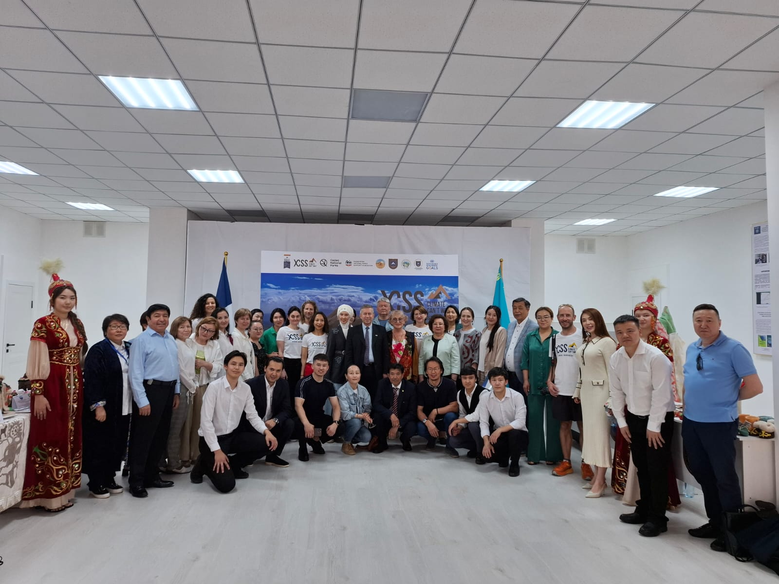
.jpeg)
