- Main
- AL-FARABI NEWS LETTERS
- Sustainable Development of the Almaty Agglomeration: A New Scientific Model for Efficient Urban Land Use
Sustainable Development of the Almaty Agglomeration: A New Scientific Model for Efficient Urban Land Use
Currently, the process of urbanization is rapidly developing in many countries around the world, including Kazakhstan. This is particularly true for the Almaty agglomeration, which in recent years has undergone significant changes due to population growth, increased migration flows, and intensified economic activity. These processes lead to the expansion of urban areas, increased pressure on infrastructure, and greater demands on natural resources. Consequently, the issue of efficient and rational use of urban land has become one of the most pressing scientific and practical challenges.
In this context, researchers at Al-Farabi Kazakh National University are implementing a large-scale scientific project aimed at a comprehensive ecological and economic assessment of urban territories within the Almaty agglomeration. The study focuses on developing a new scientifically grounded model of land management to ensure sustainable development. The project seeks to combine environmental sustainability of the urban environment with economic efficiency and social well-being.
The primary objective of the project is to conduct a comprehensive ecological and economic evaluation of urban lands in the Almaty agglomeration and to develop a model for sustainable land use. Currently, existing approaches to urban land management often fail to fully consider environmental, social, and economic factors. As a result, land resources are used inefficiently, environmental pollution occurs, green spaces diminish, and residents’ quality of life declines.
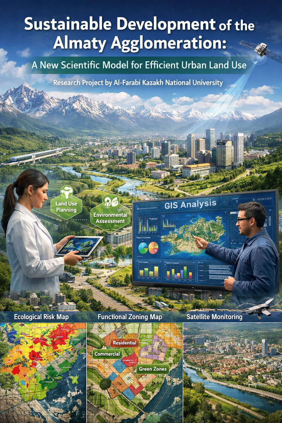
The research employs an interdisciplinary approach, integrating ecology, economics, urban studies, land evaluation, and geographic information systems (GIS). This comprehensive method allows for a thorough analysis of urban land conditions and the development of effective management solutions.
A key component of the project is the creation of an information-analytical database on the land-use system of the Almaty agglomeration. This database includes information on land cadastre, air and water quality, soil conditions, demographic indicators, infrastructure development levels, and economic parameters. The collected data are processed using modern digital technologies and spatial analysis methods.
An important direction of the research is the use of remote sensing data. Satellite imagery is employed to track changes in urban areas, reduction of green spaces, the “heat island” phenomenon, and levels of anthropogenic pressure. These methods enable precise assessment of urban environmental dynamics.
Furthermore, the project places particular emphasis on identifying environmental risks. Increased traffic, concentration of industrial facilities, and residential expansion significantly impact the environment in the Almaty agglomeration. Taking these factors into account, researchers identify ecologically hazardous zones and develop recommendations for their management.
As a result of the research, functional zoning maps, environmental risk maps, and sustainable land-use maps are produced. These maps facilitate effective urban planning, preservation of green spaces, and optimal infrastructure development. They also serve as important tools for land management authorities.
Another significant outcome of the project is the development of a sustainable land-use model. This model aims to balance environmental safety, economic efficiency, and social stability. It takes into account the conservation of natural resources and the improvement of residents’ quality of life in the context of urban development.
The practical significance of the study is substantial. Project results provide local authorities, urban planners, and environmental organizations with concrete recommendations for effective land management. In turn, this contributes to reducing environmental risks and improving the quality of life for city residents.
Moreover, the methodologies and models developed within the project can be adapted for use in other major cities in Kazakhstan. The study provides a foundation for developing a national strategy for sustainable urbanization.
From a scientific perspective, the project expands knowledge in the field of ecological and economic assessment by offering new methodological approaches. By combining geoinformation technologies, multi-criteria analysis, and modeling methods, the research contributes to the formation of an innovative urban land management system.
An important aspect of the project is the training of young scientists. Graduate students and doctoral candidates participate in the research, mastering modern scientific methods. This enhances the potential of scientific personnel and positively impacts the development of the education system.
In conclusion, the project on the comprehensive ecological and economic assessment of urban lands in the Almaty agglomeration represents an important step toward sustainable urban development. Research conducted by Al-Farabi Kazakh National University enables scientifically grounded decision-making and paves the way for creating an environmentally safe and comfortable urban environment in the future.
Other news