Dynamics of the "Ili" River water fund changes
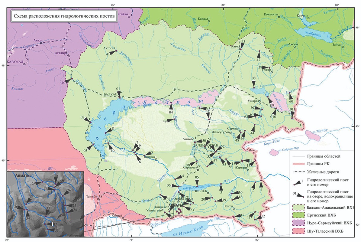
Ile Balkhash basin
Water resources play an important role in human life and ecosystems, and their effective control and management are considered integral to achieving sustainable development.
The resolution "Water for sustainable development, a decade of international action, 2018-2028" adopted by the UN General Assembly in 2016 emphasizes the need to pay more attention to sustainable development and integrated water resources management in order to achieve socio-economic and environmental goals, and to implement and promote relevant programs and projects. Kazakhstan often faces water scarcity due to its geographical location and the fact that its major rivers are located in the transboundary zone.
The work on the study of the dynamics of the water reserves of the largest water basin of Kazakhstan - Ile-Balkhash Basin (hereinafter - IBB) was carried out within the project AP09261344 "Development of methods for automatic extraction of geospatial objects from heterogeneous sources for information support of geoinformation systems". This project was carried out under my supervision in 2021-2023. The Lake Balkhash Basin is the largest lake ecosystem in Kazakhstan and is of great ecological and economic importance as it concentrates valuable natural resources. This basin produces 40 percent of all hydroelectric resources in Kazakhstan, i.e. the total potential hydroelectric resources amount to 63.5 billion kWh. The UHB covers several regions of Kazakhstan and China. The area in Kazakhstan is 353 thousand square kilometers, located in four regions: Almaty, Zhetysu, Zhambyl and Karaganda. In Almaty, Zhetysu and Zhambyl oblasts, most of the land is occupied by crops. This means that 70 percent of the basin is used to irrigate these fields.
Kazakh environmentalists say that "Lake Balkhash is waiting for an ecological disaster". This is because Lake Balkhash receives 80 percent of its main water supply from the Or River. The volume of water from the Or River is decreasing every year. For example, at least 12 cubic kilometers of flow should be maintained in the river channel or from its source from China to Kazakhstan. But now it has been reduced to 8 cubic kilometers. Therefore, solving the problem of water reserves in the SWB basin today is very urgent for the ecology and economy of Kazakhstan.
Regarding the above question, we decided to develop a program that tracks how much the water in a river or over the last 20 years has decreased. To do this we first need to get images of the river or from remote sensing satellite images. These satellite images are all stored on the Google Earth Engine platform. Google Earth Engine is a cloud-based platform for geospatial analysis at a planetary scale that leverages Google's vast computational power to address important societal issues such as droughts, natural disasters, water management, climate control and environmental protection. Landsat satellite images of planet Earth on this platform have survived since 1970. Since the images are updated every 16 days, we have collected pictures of the border part of the river or with China. All operations are done on Google Earth Engine platform, which means that on this platform you can determine any computational formulas on the satellite images, areas such as water, sand, Green Valley in the image.
Once you collect the satellite images, the next step is to filter these images. Because if we use all the images every 16 days since 1970, firstly, the platform will be very busy, the analytical work will take several days; secondly, we don't need images taken on cloudy days and in the season when the water is in the rivers. That is, for our analytical work we need images taken only in June-August, of which we will use only the first 200 images.
We filtered the images and stored the 200 clean images taken in June-August in one collection. Now you need a program that can identify rivers from these images. That is, you can recognize watery sandy land, green valley, and glaciers from the heat rays in each satellite image. One such method is the Viola-Jones method. Viola-Jones method is an algorithm that allows the satellite to detect rivers in the images. The algorithm for this method is available in dataset on the Google Earth Engine platform and has been successfully applied to our tool. An example of detecting rivers on a map using the Viola-Jones method can be seen in the figure below.
Once the rivers have been identified, the next step is to observe and calculate how the width of the river or border area with China has changed. To do this, we need to enter an algorithm into this program that determines the width of the river and calculates it using an orthogonal line.
Here we mark the center of the river directly on the image to get the orthogonal directions. The program reads this part into a 9x9 pixel image. Then the width of the river is calculated as follows for each pixel of the centerline. First, a linear segment ωm, whose length is three times the distance to the nearest non-water pixel (ωb) (red line), is formed in the orthogonal direction, and then the algorithm calculates the river width (ω) by multiplying ωm by the average value of the channel mask along ωm.
Using these algorithms, we created an application.
On the map, all rivers are marked in yellow. It is enough to select the desired section and click on the center line of the river (yellow). On the right is an interactive frame-by-frame animation of a 300x300 pixel river in the center, presented in gif format, showing the change in river width throughout the specified period. Timelapse was used to create this animation. There is a slider in the upper right corner that you can use to select the time period.
After selecting the desired area of the river or, think for another 2-3 minutes. Then shows the results obtained to the user in the form of a graph.
According to the results of this graph, the width of the Ili River was 145 meters on average from 1992 to 2002, and then 75 meters on average from 2002 to 2019. That is, the width of the river has halved in the last 20 years.
The purpose of this analytical work was to prove the shrinking of the river water or using satellite images. Now the next step is to come up with ways to make more efficient and economical use of water reserves, which are halving every 20 years.
So today, Central Asian states often face water shortages. But the consequences of this environmental problem affect the whole world. Therefore, it is necessary to monitor water reserves in a timely manner and timely implement necessary measures based on the results obtained from the data.
Asel OSPAN,
Madina Mansurova