- Main
- AL-FARABI NEWS LETTERS
- Modeling Recreational Carrying Capacity in Ile-Alatau National Park: An Innovative Research Initiative by KazNU Scientists to Prevent Overtourism
Modeling Recreational Carrying Capacity in Ile-Alatau National Park: An Innovative Research Initiative by KazNU Scientists to Prevent Overtourism
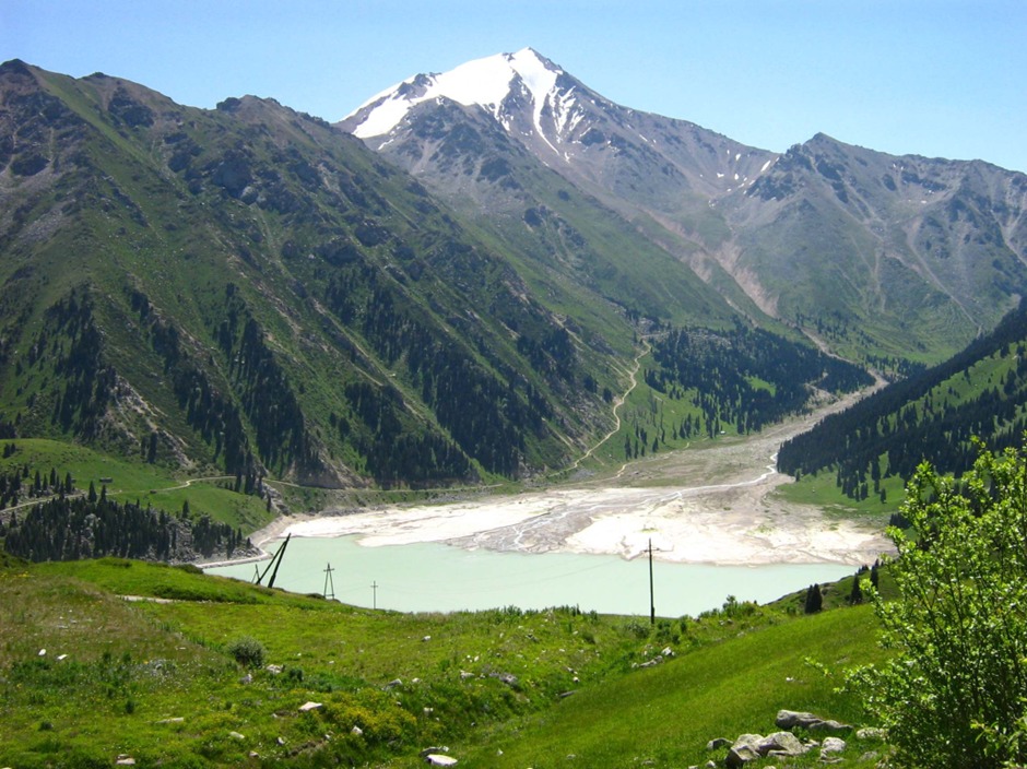
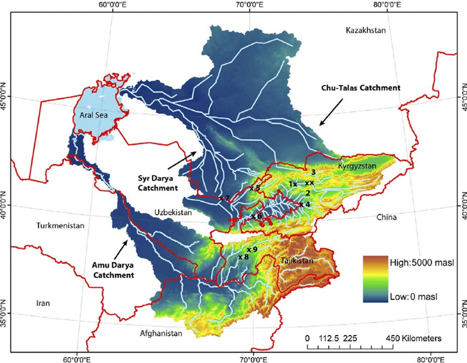
Protected natural areas in Kazakhstan have recently been facing increasing pressure due to the rapid growth of tourism. This trend is particularly visible in Ile-Alatau National Park, where visitor numbers rise sharply during weekends and peak seasons. Such dynamics intensify anthropogenic pressure, accelerate trail degradation, threaten biodiversity, and create risks for fragile mountain ecosystems.
In response to these challenges, researchers from Al-Farabi Kazakh National University are implementing an interdisciplinary scientific project aimed at developing advanced methods for monitoring and modeling recreational carrying capacity. The initiative seeks to prevent overtourism, preserve ecological integrity, and promote sustainable tourism management practices.
The primary objective of the project is to design and test a flexible and accurate model for assessing recreational carrying capacity using Ile-Alatau National Park as a case study. To achieve this goal, the research integrates three major technological components: unmanned aerial vehicles (UAVs), geographic information systems (GIS), and artificial intelligence (AI).
UAVs are used to conduct регуляр aerial and video monitoring of the park’s most popular tourist routes, including Kok-Zhailau, Gorelnik, Furmanov Peak, and Butakovsky Waterfall. Weekly drone flights allow researchers to capture fluctuations in visitor density depending on season, weather conditions, and day of the week. In areas where drone access is limited, stationary cameras are installed to ensure comprehensive data collection.
The recorded video materials are uploaded to cloud storage and processed using AI-based computer vision algorithms. These systems automatically detect and count visitors on the trails. The trained model is designed to adapt to varying lighting conditions, complex mountainous terrain, and seasonal landscape changes. This significantly increases counting accuracy while minimizing human error and enabling efficient processing of large datasets.
A key scientific innovation of the project lies in the application of fuzzy linear programming to calculate recreational carrying capacity. Traditional linear models often fail to capture the nonlinear nature of environmental impacts. In ecological systems, visitor pressure may remain manageable up to a certain threshold, after which degradation can accelerate exponentially. The proposed nonlinear approach better reflects these dynamics.
The developed model incorporates visitor density, ecological resilience indicators, infrastructure conditions, and seasonal variability. As a result, it determines the maximum permissible number of visitors for each route and allows scenario-based simulations for management decision-making. This provides a scientific foundation for implementing visitor quotas, reservation systems, or redirecting tourists to alternative trails.
GIS plays a central role in spatial data analysis. Using GIS tools, researchers create maps of ecologically vulnerable zones and compare them with visitor density patterns. This enables the identification of high-risk areas requiring regulation and targeted conservation measures. Such digital mapping tools support evidence-based and timely management decisions.
The project is not limited to theoretical modeling; it includes extensive field validation. Drone flight schedules, filming parameters, and data-processing algorithms are tested in real conditions. The results are continuously used to refine the model and improve predictive accuracy.
From a scientific perspective, this research represents one of the first comprehensive attempts in Kazakhstan to integrate UAV technology, artificial intelligence, and fuzzy modeling for evaluating recreational pressure in natural mountain environments. Previous approaches largely relied on statistical averages and normative calculations, which limited their adaptability and responsiveness.
The socio-economic relevance of the project is equally significant. Tourism is a key driver of regional development; however, uncontrolled growth may lead to the depletion of natural capital. The proposed system aims to balance environmental protection with high-quality visitor experience. By implementing innovative digital solutions, Kazakhstan strengthens its position in sustainable tourism and environmental governance.
The expected outcomes of the project include:
– a real-time monitoring system for tourist flows;
– a nonlinear model for assessing recreational carrying capacity;
– digital maps of environmentally vulnerable areas;
– practical management recommendations for optimizing tourist routes.
The research is scheduled for 2025–2027 and follows a strongly interdisciplinary approach, involving experts in ecology, geography, information technology, and mathematical modeling.
Overall, this initiative led by KazNU scientists demonstrates how advanced digital technologies can be effectively combined with environmental conservation goals. The model developed for Ile-Alatau National Park has the potential to be adapted to other protected areas across Kazakhstan, contributing to the establishment of a scientifically grounded system for managing tourist flows.
Preserving natural heritage while supporting tourism development is a strategic challenge of our time. This project represents a concrete step toward achieving a sustainable balance between human activity and fragile mountain ecosystems.
Other news