- Басты бет
- Жаңалықтар
- «Тұрақты даму мақсаттары» жобасының «Құрлық экожүйелерін сақтау» бағыты бойынша Әл-Фараби атындағы ҚазҰУ-дың «Ғарыштық технологиялар және Жерді қашықтан зондтау» орталығының қызметкерлері мен «Картография және геоинформатика» және «География, жерге орналастыру және кадастр» кафедрасының оқытушы-профессорлар құрамы 2023 жылдың тамыз айында Батыс өңірге (Ақтөбе, Батыс Қазақстан, Атырау облыстары) далалық экспедициясын жүргізді.
«Тұрақты даму мақсаттары» жобасының «Құрлық экожүйелерін сақтау» бағыты бойынша Әл-Фараби атындағы ҚазҰУ-дың «Ғарыштық технологиялар және Жерді қашықтан зондтау» орталығының қызметкерлері мен «Картография және геоинформатика» және «География, жерге орналастыру және кадастр» кафедрасының оқытушы-профессорлар құрамы 2023 жылдың тамыз айында Батыс өңірге (Ақтөбе, Батыс Қазақстан, Атырау облыстары) далалық экспедициясын жүргізді.
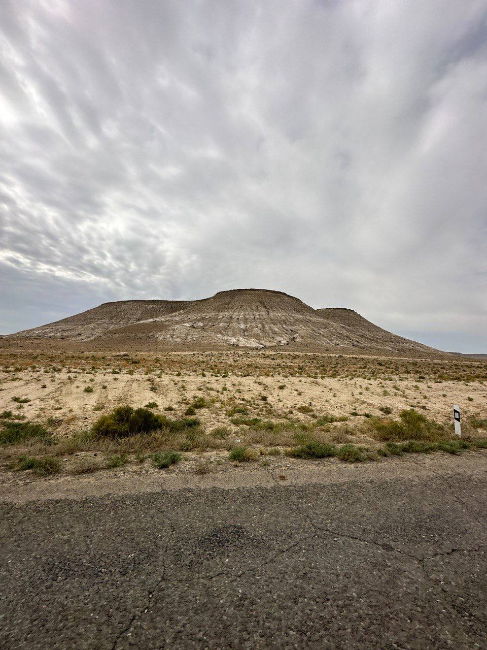
Экспедицияның негізі: AP14871372 «Қазақстанның Батыс аймағындағы климаттық апаттардың (құрғақшылық пен эрозия) тәуекелдерін және олардың ауыл шаруашылығына әсерін бағалаудың геокеңістіктік тәсілдемесі» бағдарламасы бойынша ҒЗЖ орындау.
Экспедицияның мақсаты: зерттеу аумағын физикалық-географиялық сипаттау бойынша далалық жұмыстарды жүргізу, үлгілерді іріктеумен топырақ шурфтарын сипаттау, дрон көмегімен әуе бейне және фототүсірілім жүргізу, ЖҚЗ деректерімен салыстыру үшін аумақты визуалды талдау. Ауа райы құбылыстарын, табиғи кешендердің даму тарихын аспаптық бақылауды растау мақсатында жергілікті тұрғындармен, мамандармен сауалнама жүргізу.
 2023 жылғы 16-31 тамыз аралығында ҒЗЖ күнтізбелік жоспарына сәйкес Қазақстанның батыс өңіріне (Ақтөбе, Батыс Қазақстан, Атырау және Маңғыстау облыстары) экспедициялық сапар өткізілді. Экспедициялық топ мүшелерін бастапқы далалық өңдеу және негіздеу жол бойындағы қонақ үйлерде жүргізілді. Дала кезеңінде барлық жоспарланған тірек нүктелерінде жұмыстар жүргізілді. Нұсқауларға сәйкес бақылау нүктелерінде физикалық-географиялық сипаттама, өсімдік жамылғысының сипаттамасы, проективті жабынды, топырақ шурфтарын анықтау, топырақ үлгілерін іріктеу жүргізілді. ПТК-ны сипаттау кезінде дрон қолданылды. Барлығы 15 тірек нүктесі бойынша физика-географиялық сипаттама жүргізілді.


Топырақ үлгілері, тірек нүктелерінен және бейне-фотоматериалдардан далалық материал жиналды.
Басқа жаңалықтар