KAZAKH-CHINESE JOINT LABORATORY IMPLEMENTS ECO-PROJECTS
In the age of globalization, modern environmental challenges cannot be solved without advanced scientific solutions and international solidarity. An example of such integration was the joint project of the Al-Farabi Kazakh National University and the Xinjiang Institute of Ecology and Geography of the Chinese Academy of Sciences.
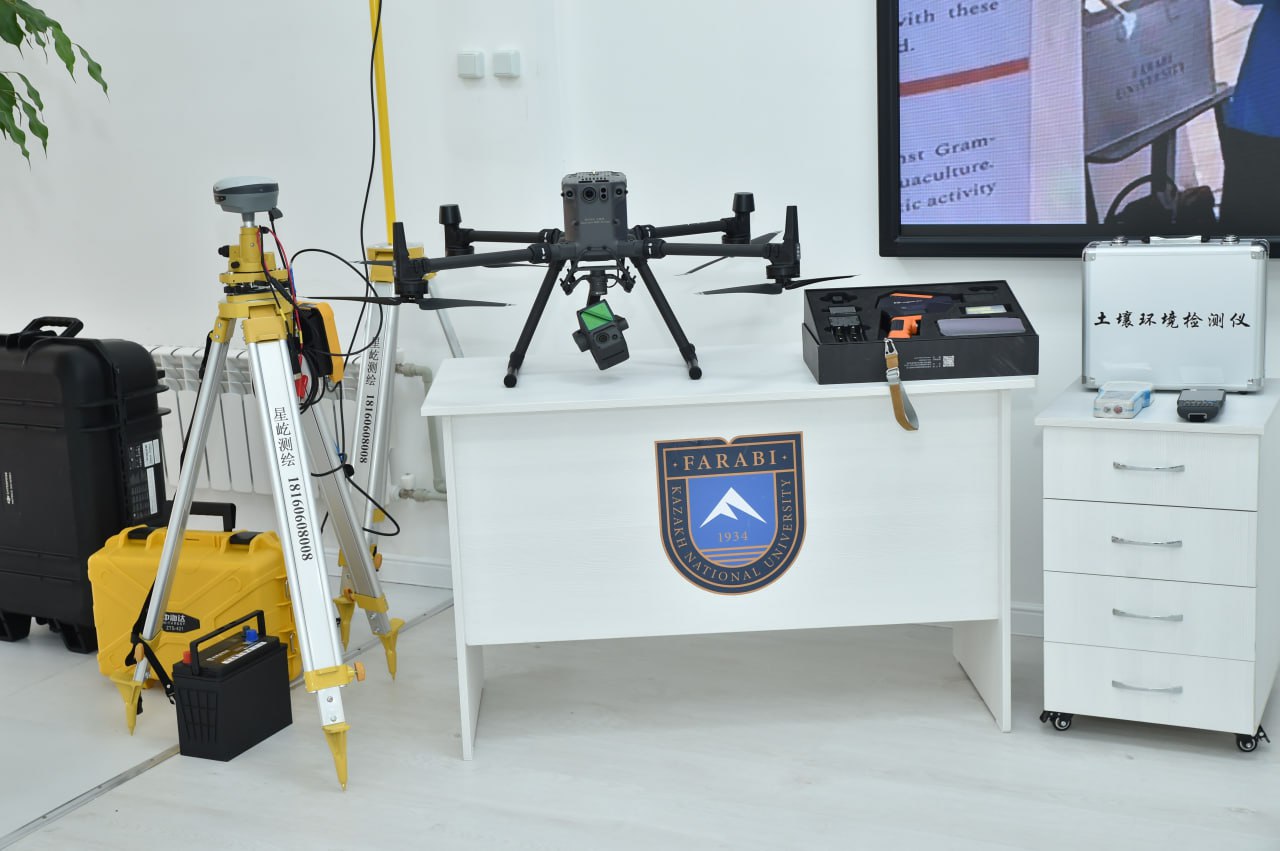
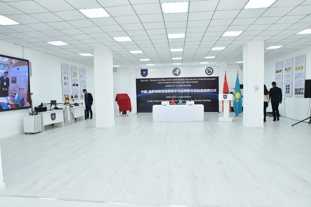
The Kazakh-Chinese Laboratory "Remote Sensing Technologies and their Applications" is successfully operating on the basis of KazNU. The key factor in its development was the technical equipment provided by Chinese partners. The laboratory has assembled equipment capable of performing tasks of the highest level of complexity, from 3D cartography to monitoring microclimatic processes. The DJI Matrice 300 RTK and DJI Mavic 3M unmanned aerial vehicles occupy a central place in the laboratory's technical arsenal. The first one is characterized by high positioning accuracy and load capacity, allowing the installation of professional sensors for aerial photography, mapping and environmental monitoring. The second DJI Mavic 3M aircraft is compact and mobile. It is ideal for operational missions and filming in hard-to-reach areas. With their help, pastures, reservoirs, farmlands are monitored, and areas of soil degradation are recorded.

The Zenmuse L1 lidar system plays an important role in 3D terrain modeling, which allows you to build three-dimensional digital terrain models with high detail. Its data is indispensable in the analysis of landslide and mudflow risks, especially in the mountainous regions of southern Kazakhstan. It comes with a Zenmuse P1 camera equipped with a full-frame sensor that provides ultra-high resolution for photogrammetry and cartographic work.
Geodetic and portable spectrometers used to determine the physico-chemical characteristics of soils and vegetation complement the field arsenal. These data make it possible to refine ecological models and improve the accuracy of ground-based observations.
Data processing, analysis and visualization is carried out using leading software solutions: ArcGIS Pro, QGIS and DJI Terra. These platforms make it possible not only to build accurate maps, but also to model climate and natural processes, assess risks, and develop scenarios for sustainable environmental management.
Thanks to this equipment, the laboratory participates in a number of significant scientific and applied projects.
Almaty is monitoring the state of the atmosphere using the WRF-CHIMERE climate model, aimed at reducing the concentration of harmful PM2.5 particles. Studies of the water balance of the Ili-Balkhash basin are being conducted, and the processes of land degradation in Central Kazakhstan are being analyzed. In the mountainous regions, in cooperation with the RSE "Kazselezashchita" of the Ministry of Emergency Situations of the Republic of Kazakhstan, work is underway to assess avalanche and mudflow hazards, and passports of landslide sites in the Turkestan region are being compiled.
Thus, the laboratory becomes not just a scientific structure, but an international high-tech platform where advanced engineering solutions directly serve the needs of ecology, sustainable development and safety. The support of the Chinese side in the form of advanced equipment allowed not only to strengthen the technical potential of KazNU, but also to bring joint research to a level appropriate to the global environmental challenges of the 21st century.
Press-service of Al-Farabi Kazakh National University