- Main
- News
- Brief report of the Aktobe region as of April 23-24, 2024 as part of the MegaGrant implementation
Brief report of the Aktobe region as of April 23-24, 2024 as part of the MegaGrant implementation

As part of a research expedition in the West Kazakhstan region, a group of scientists from Al-Farabi Kazakh National Univeristy, a meeting was held with the emergency department of the Aktobe region emergency department, the warning department Taras Kovalenko, where the current situation about floods in the city of Aktobe and in the region as a whole was discussed (Fig. 1). Research aimed at achieving SDG 6 "Clean water and sanitation", SDG 11 "Sustainable cities and settlements", SDG 11 "Combating climate change", SDG 14 "Protection of marine ecosystems", SDG 15 "Protection of terrestrial ecosystems", SDG 17 "Partnership in the interest of sustainable development".
The main causes of flooding were: autumn soil moisture, which exceeded the long-term average in the basins of the Kargaly, Kosestek, Or, Temir, Irgiz, and Uil rivers, which amounted to about 90 mm (norm 32-50 mm); soil freezing depth up to 155 cm; ice crust on the surface of the earth. In a further discussion by the head of the Emergency Situations Department of the Emergency Situations Department, settlements with potential flooding were marked on the map of the Aktobe region.
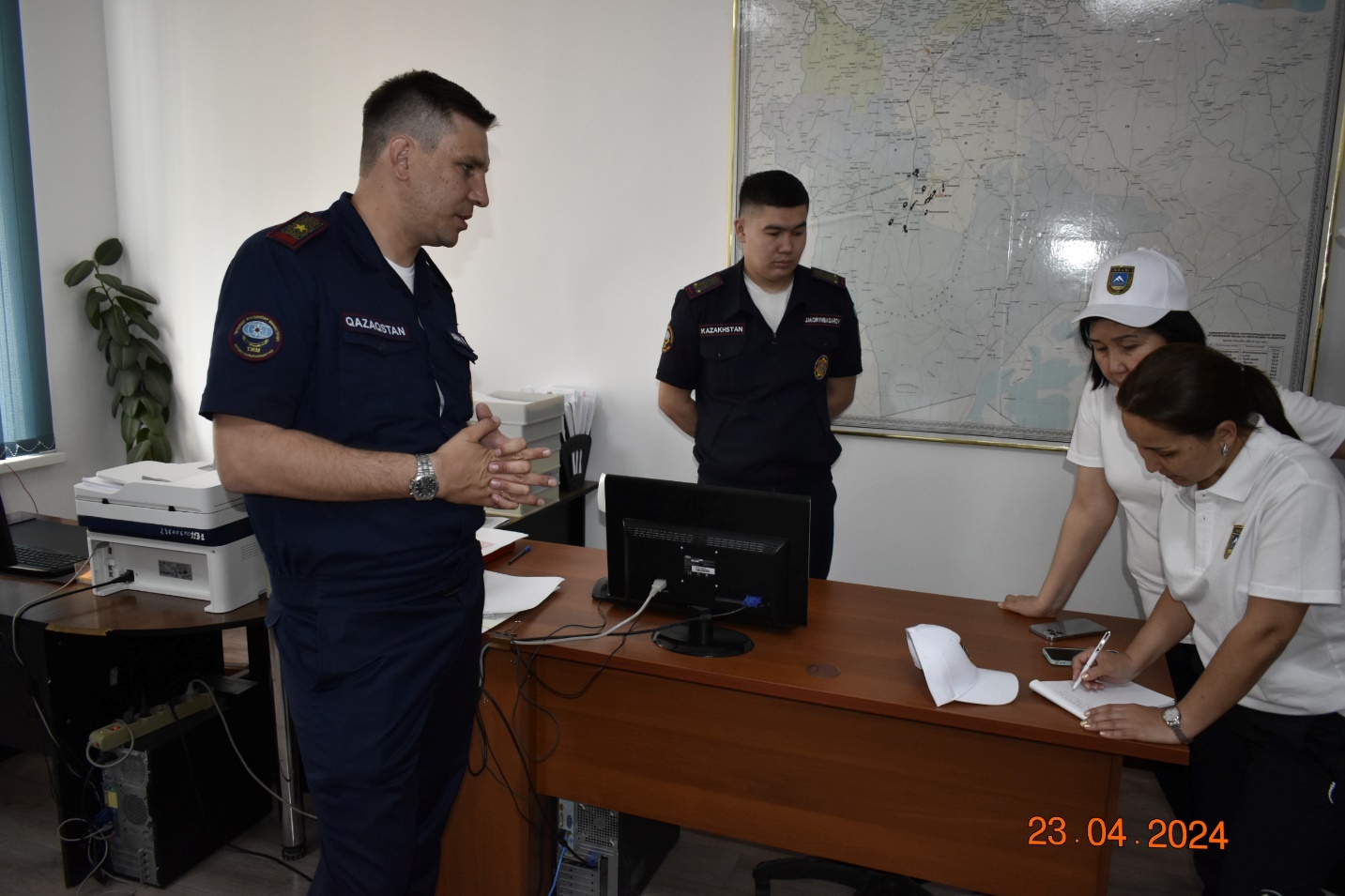
Figure 1 Emergency Situations Department of the Aktobe region
According to the Emergency Situations Department of the Aktobe region, as of today, as a result of overflows and erosion of road sections, 30 settlements have been cut off since the beginning of the period. (Kobdinsky district - Kobda settlement, Utek, Sarybulak, Zharyk, Akrab, Kyzylzhar, Karakemer, Zhirenkopa, Kogaly, Sogaly, Kokuy; Uilsky district - Wil settlement, Akshatau settlement, Karasu settlement, Karatal village, Karaoi village, Kotibar village, Altyndy village, Beskospa village , Sartogay village, Koktogay village, Ayke village, Irgiz district - Nura village, Belsher village) (Fig. 2).
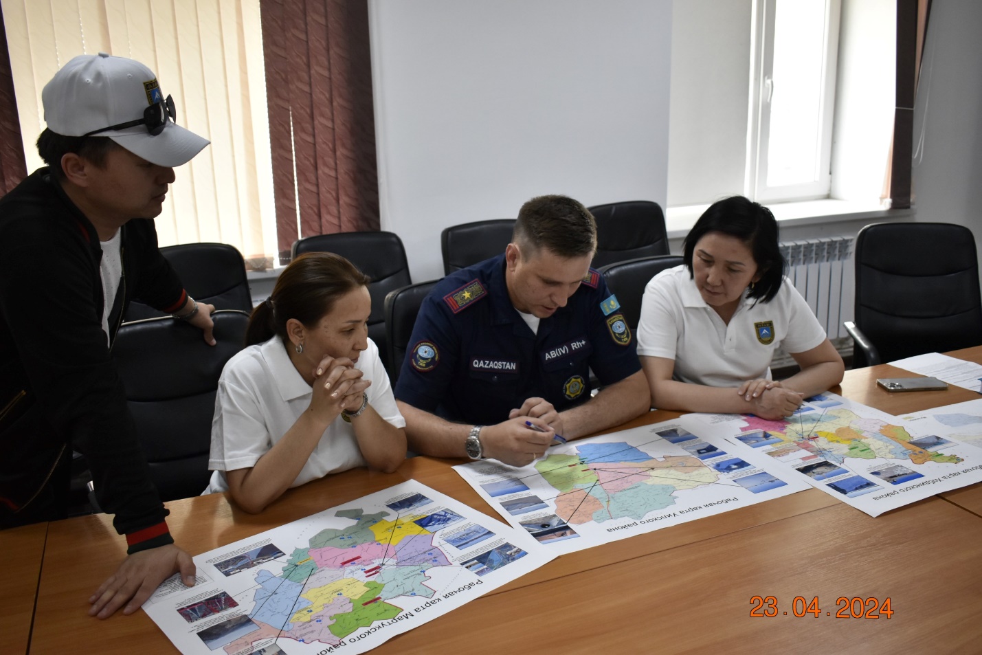
Figure 2 Work process in emergency situations DES
During reconnaissance work within the city of Aktobe, flood zones occupied by the right tributary of the Ilek River - Kargaly (the Kirpichny dacha area) were examined. The height of the area is 320 m. The width of the channel in the upper reaches is 20-50 m. According to the Emergency Situations Department of the Aktobe region, the water level of the Ilek River was 0.5-0.7 m above the critical level, which flooded the coastal zone by 150-200 m. The prompt response of the Aktobe emergency department prevented further development of the flood due to blasting operations at the sites where ice jams formed. According to our observations, the flooded areas covered nearby summer cottages, as well as floodplain tugai forests. In the valley of the river bed at the time of the survey, the beginning of the development of erosion processes (gully formation) was observed, as well as a change in the structure of tree and shrub vegetation, which could subsequently lead to a violation of the integrity of the aquatic ecosystem (Fig. 3).
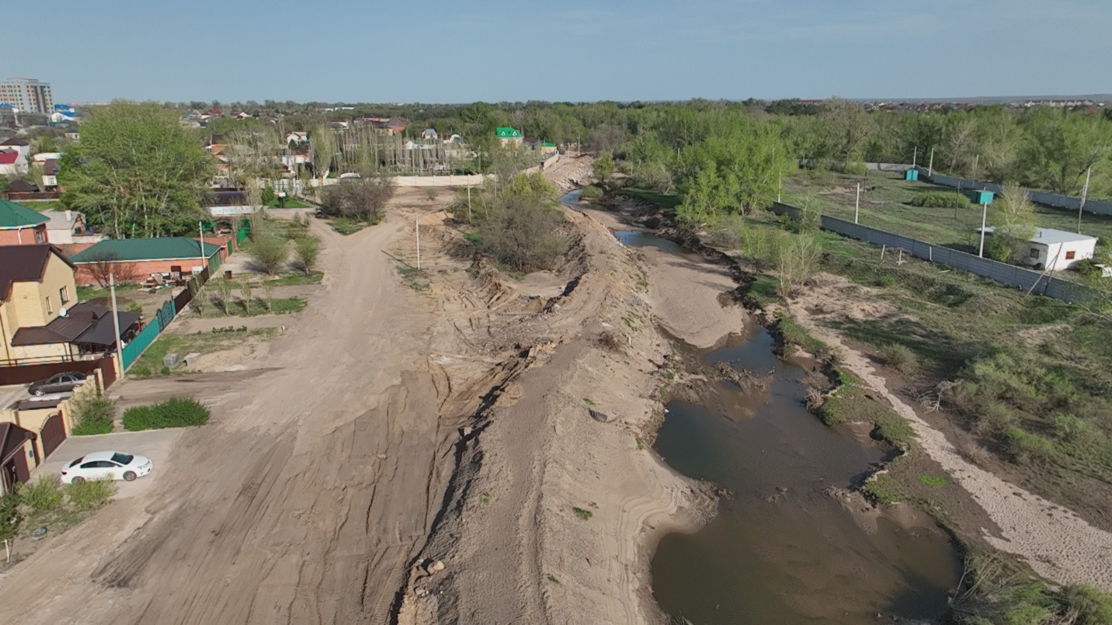
Figure 3 Flooded areas, protective dam in the floodplain area of the Kargaly River
Within the border of Aktobe, the tourist recreation center “Green Land” was partially damaged by the flood. During the peaks of flood waters, the maximum level reached 3.0 meters from the water's edge. Tourist facilities (piers, recreational and food places) were flooded (Fig. 4).
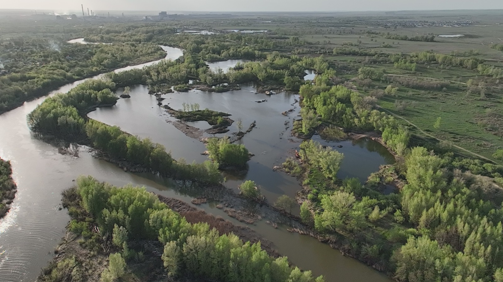
Figure 4 View from above about the state of the floodplain of the Ilek River in the area of the Green Land recreation center
According to the Emergency Situations Department of the Aktobe Region, the village of Kobda was one of the first settlements that was classified as high risk. The village is located on the left bank of the Kobda River. The width of the river is from 20 to 200 m with a maximum throughput of 330 m³/s, and in 2024 the water content at the time of the peak melting of melt and snow water was up to 800 m³/s. During the survey, in the lowlands (natural depressions) there are still areas of accumulation of water from two years ago formed due to the flow of temporary watercourses from the slopes into the river bed. Kobdy. During the peak of the flood waters, it overflowed over embankment dams, as a result of which houses located near the depression were damaged. More than 30 houses were flooded (Fig. 5). One of the reasons for the flooding was the filling of the natural depression with water from the previous flood water.
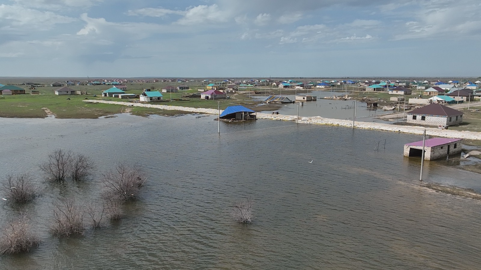
Figure 5 Flooded and destroyed houses in Kobda village
Also, one of the main problems is that the lands of the water fund and structures in the early 2000s were transferred to the balance of local districts - akimats. Many lands were transferred by akimats for individual housing construction (Fig. 6). In order not to repeat this situation, it is necessary to return all structures and land to the water sector, as well as strengthen water management organizations.
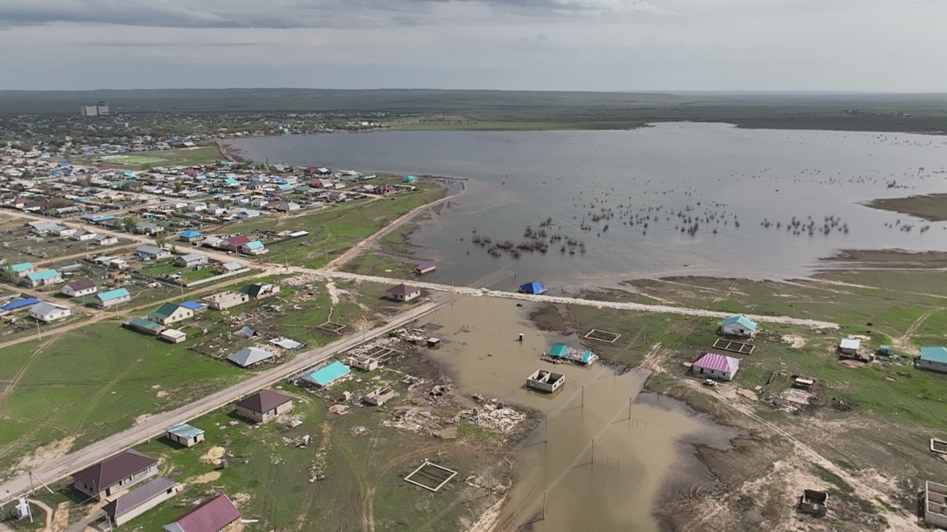
Figure 6 Kobda village, a lake formed in a depression that overflowed its banks
As a result of the survey, the following problems were identified in the Aktobe region:
1. There is no short-term forecasting system.
2. Lack of automated, harmonized data collection and analysis.
3. Lack of hydrologists and other specialized specialists.
4. Lack of gauging stations on the Kargaly and Ilek rivers.
5. Repair of hydraulic structures.
6. Clearing river beds.